


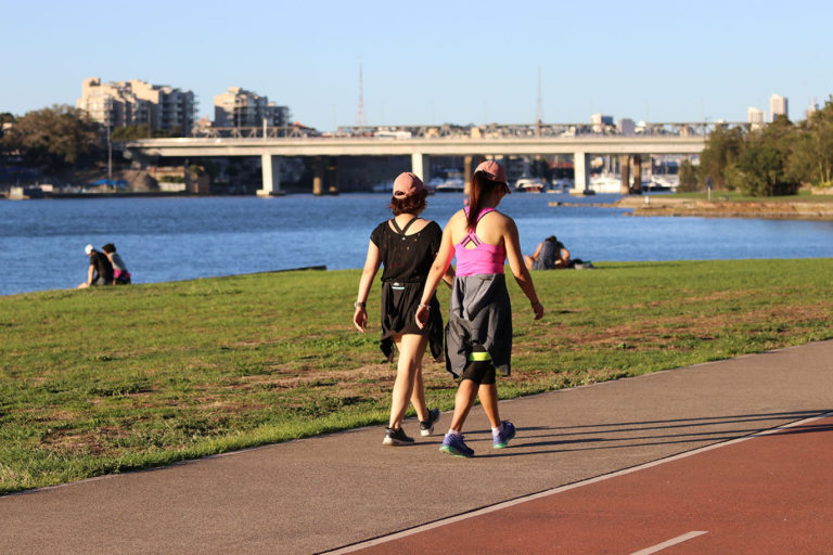
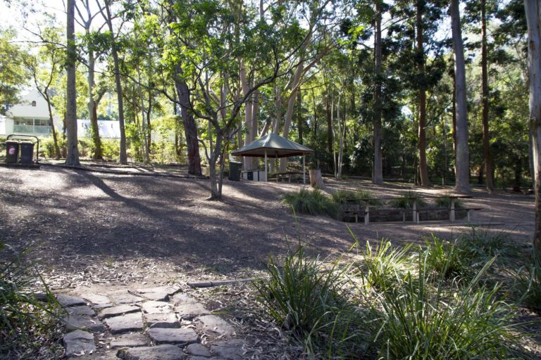
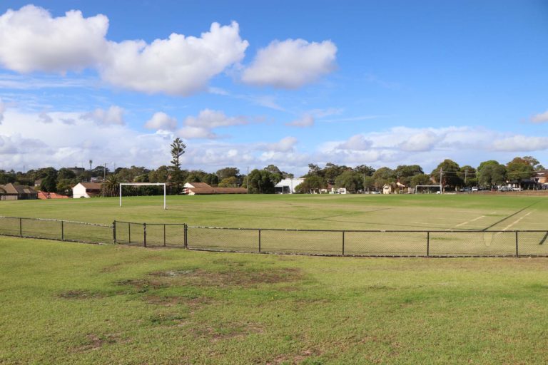
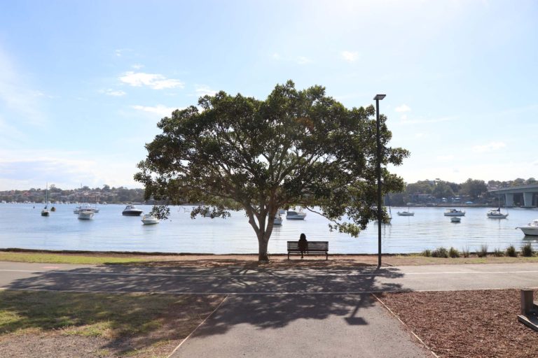
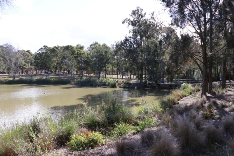
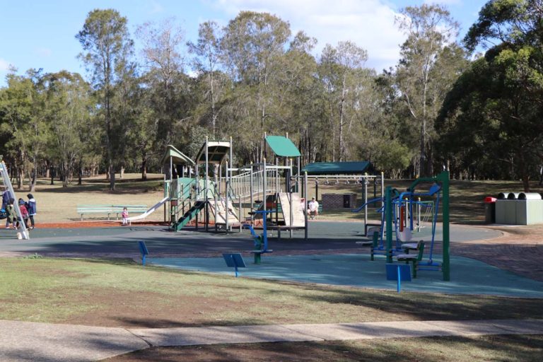
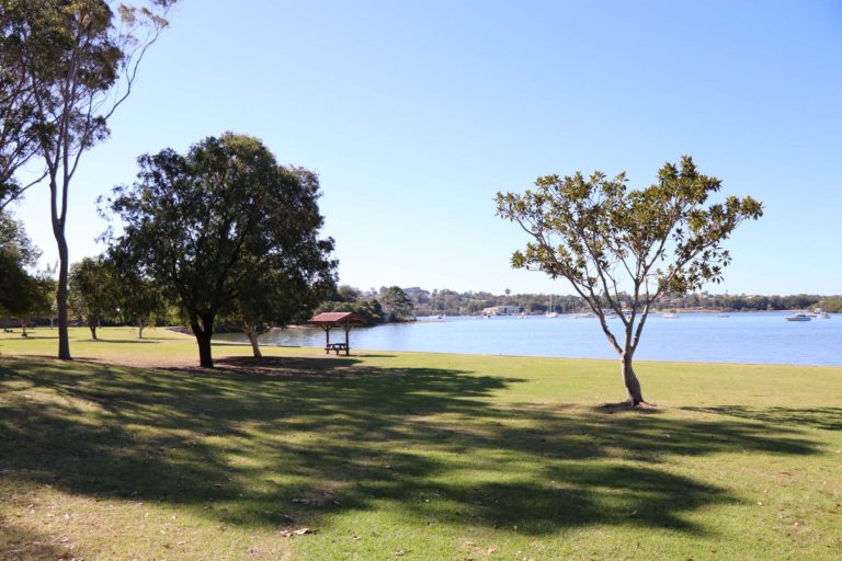
Putney Park
Located right on the water, Putney Park is a great place for group events. Features include extensive grass and natural areas, barbecue and picnic facilities, and a large playground with water features. Putney Park has been investigated for potential swimming as part of the Parramatta River Masterplan.
Pellisier Rd, Putney NSW 2112
Brickpit Ring Walk
Previously used as a source of clay to make the millions of bricks that were used to build Sydney, the award-winning Brickpit Ring Walk is now home to the endangered Green and Golden Bell frog. Take a walk around the Brickpit 'pond' to discover its history and the evolution of the frog’s habitat.
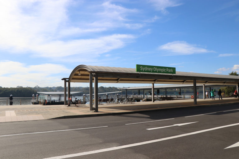
Sydney Olympic Park NSW 2127
Bedlam Bay
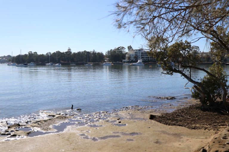
Bedlam Bay is located at the base of the Parramatta River Regional Park in Gladesville. The area is home to the Happy Hens Community Garden and Bedlam Bay Bushcare and also features scenic foreshore walking paths, boat jetty and hire and sports fields. In 2020 Hunter’s Hill Council selected the location as a potential swim site on the Parramatta River. Water quality monitoring is currently being undertaken on a weekly basis by Sydney Water’s RiverWatch program, and the site is planned to open in late 2023.
Campbell Dr, Gladesville NSW 2111
WATER QUALITY FORECAST
Sorry, live data is not available at this time.Please check back later.
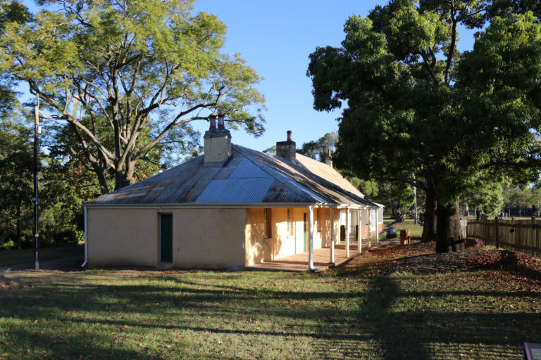
Dodds Farm
Dodds Farm was established as part of the Rose Hill settlement by Governor Arthur Phillip in November 1788. Named after Henry Edward Dodd who was one of the few experienced farmers at the time, the site became the first Government Farm which provided the fledgling colony with maize and other essential food crops. The European settlers were attracted to the fertile soil along the Parramatta River due to the Aboriginal land management practices such as the regular burning of grasses.
Parramatta Park, O'Connell St Parramatta NSW 2150
Abbotsford Wharf
Upgraded in 2018, Abbotsford Wharf has a new 'kiss and ride' zone, improved stair access, bike racks, and a covered entry and gangway.
Great North Road, Abbotsford NSW 2046
Airey Park
In addition to playing fields, this park features cricket practice wickets, children’s playground, fun and fitness track, and barbecue and picnic shelters.
Bates St, Homebush NSW 2140
Airey Park

This playground features a large colourful, shade structure, swings, including an accessible swing seat, climbing play gym and softfall surface. There is also a fun and fitness track, barbecue and picnic facilities and public toilets.
Bates St, Homebush NSW 2140
Allen Street Reserve
Bordering Powells Creek, this local park includes fitness equipment, a dog off-leash area and seating.
Allen St, Homebush NSW 2140
Anderson Park
Located on the Ryde Riverwalk, this park features picnic shelters and barbecues, playground, toilets and a small carpark.
Corner Belmore Street and Rothsay Avenue, Ryde NSW 2112
Anderson Park
Located on the Ryde Riverwalk, this playground has a boat-themed climbing gym, swings, small rope tower net, rockers and twisters. There are also picnic shelters and barbecues, toilets and a small carpark.
Corner Belmore Street and Rothsay Avenue, Ryde NSW 2112
Arista Way Playground
Located in the River Park, this enclosed playground features a boat-shaped climbing play gym with ladder, slide and cubby house, rockers, and see-saw.
Arista Way, Ermington NSW 2115
Ashley Brown Reserve
This popular park includes a multi-use sports field, including a baseball diamond, leafy reserve and car park.
Northcott Road, Lalor Park NSW 2147
Auburn Botanic Gardens
The Auburn Botanic Gardens is located along Duck River and covers an area of 9.7 hectares. Key features include the Japanese garden, a fauna reserve and aviary, and an equal access playground. A community picnic area with free communal barbecues, playground and public toilets, is located immediately outside the gardens.
99 Chiswick Road, Auburn NSW 2144
Auburn Botanic Gardens
The Auburn Botanic Gardens has two playgrounds that include a large climbing play gym with multiple slides, accessible swing, activity stations and rockers. There is also a fauna reserve and aviary, Japanese Garden with fish and ducks and a street library. Entry is free for all children under 16 and Auburn residents all year round, and other adults on week days during the school term. On weekends and school holidays, entry is $4 and $5 during the Cherry Blossom and Autumn Colours festivals.
Chisholm Rd & Chiswick Rd, Auburn NSW 2144
Badu Mangrove Boardwalk
Follow the winding timber boardwalk in Bicentennial Park to discover surviving riverside wetlands that shelter colourful waterbirds plus the largest mangrove forest remaining on the Parramatta River.
Balmain Rowing Club
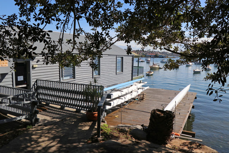
One of the oldest rowing clubs in Sydney, Balmain Rowing Club offers competitive and recreational rowing opportunities for all ages. The spectacular views of Iron Cove Bridge and Cockatoo Island make it an ideal location for for weddings and other celebrations.
White St, Balmain NSW 2041
Balmain Sailing Club
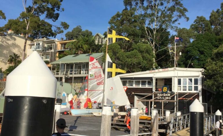
Located in Birchgrove, the club offers regular opportunities for racing and cruising and a sailing school for adults. It is an ideal way to experience the Parramatta.
Water St, Birchgrove NSW 2041
Bangor Park
Located along the Duck River, this local park includes a children’s playground, walking path and seating.
Bangor St, Auburn NSW 2144
Bangor Park
Located along the Duck River, this local playground includes swings, climbing gym equipment and softfall surface.
Bangor St, Auburn NSW 2144
Banjo Paterson Park
A beautiful park on the water's edge with scenic views of the Parramatta River. Facilities include barbecues, picnic areas, walking paths and accessible toilets.
Punt Rd, Gladesville NSW 2111
Banjo Paterson Park
Located on the water's edge with scenic views of the Parramatta River, this partially covered playground features a rocket-shaped, giant slide tower, swings, wooden climbing play gym and rocker. There are also accessible toilets, and barbecue and picnic facilities.
Punt Rd, Gladesville NSW 2111
Battersea Park
Battersea Park is located right on the water's edge and includes barbecues with picnic tables and an undercover area. There is also a play equipment and wheelcair access.
Battersea St, Abbotsford NSW 2046
Battersea Park
This partially covered, local playground has a bright blue coloured climbing slope with slides, swings, spinner and rocker and sandy surface. There are also barbecues with covered picnic tables and toilets.
Battersea St, Abbotsford NSW 2046
Bay Marker
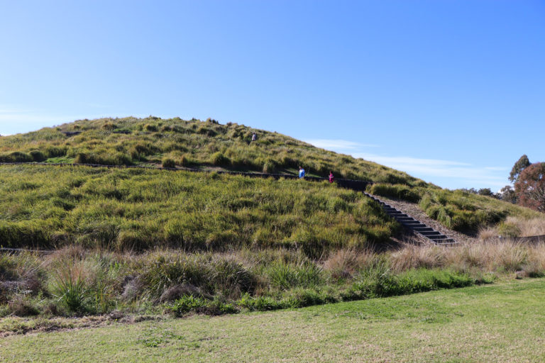
Ride or walk the spiraling pathway to the top of the Bay Marker lookout for views of the wetlands, Haslams Creek, Homebush Bay and the city skyline.
29 Bennelong Pkwy, Wentworth Point NSW 2127
Bay to Bay Cycleway
The Bay to Bay Cycleway is a 23 kilometre track that extends from Settlers Park in Ryde to Botany Bay. Much of the track runs aside the historic Cooks River. The time required to walk the Strathfield section is 90 minutes.
Bay to Bay Cycleway
The Bay to Bay Cycleway is a 23 kilometre track that extends from Settlers Park in Ryde to Botany Bay. Much of the track runs aside the historic Cooks River.
Bayview Park
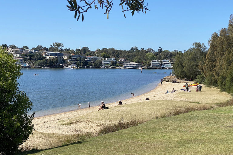
Located at the end of Burwood Road in Concord, Bayview Park features scenic views of the Parramatta River. There is a small sandy beach, which is being considered as a potential future swimming site. Facilities include barbecues, covered picnic tables and toilets, and there is plenty of tree shade to enjoy a relaxing picnic. Bayview Park has a public boat ramp and is also accessible by public transport.
Bayview Park, Concord NSW 2137
Bayview Park
Located on the Parramatta River, this playground includes a small climbing gym with a slide, spherical shaped climbing web and swings. Other facilities include barbecues, covered picnic tables and toilets. There is also a small sandy beach, which is being considered as a potential future swimming site.
Bayview Park, Concord NSW 2137
Bayview Park
Reopened in November 2022, the upgraded swimming baths feature a new netted enclosure, outdoor shower and improved foreshore access. The swim site is located next to Bayview Park, which offers scenic views of the Parramatta River. Facilities include a boat ramp, playground, covered picnic tables, BBQs and toilets.
Burwood Rd, Concord NSW 2137
WATER QUALITY FORECAST
| Saturday, 20 April 2024 | ||
Weather
17.7°
Showers
S 30km/h
2mm rain since 9am
|
Water QualityPollution is unlikely. Enjoy your swim! |
Tides
HT metres
at 00:00
LT metres
at 00:00 |
Bayview Park Boat Ramp
Located at the end of Burwood Road, there is a pontoon on the ramp, lighting, barbecue and picnic facilities, playground, toilets, and parking for more than 50 cars.
Burwood Rd, Concord NSW 2137
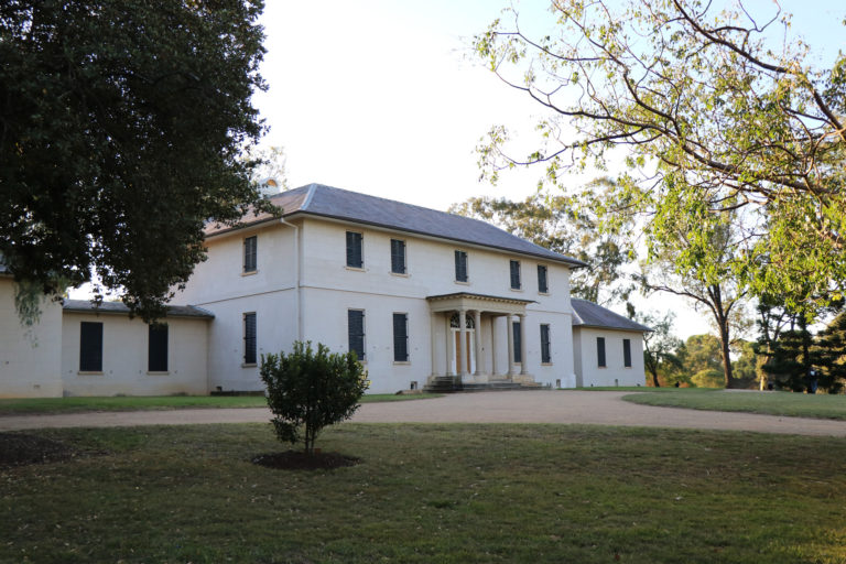
Bella Vista Farm Walking Tracks
Bella Vista Farm is an historic farm complex. Established in the late 1700s, it features a two-storey homestead, Bunya Pine lined driveway and various farm outbuildings set on a prominent hilltop. There are several walking trails to choose from as well as barbecue facilities, picnic tables and toilets.
Bennelong Park
The park is located on the waterfront, next to Kissing Point Park. It features a playground, cycleway and walking paths.
Waterview St, Putney NSW 2112
Bicentennial Park, Sydney Olympic Park

Bicentennial Park is a 40-hectare scenic parkland that offers a wide range of activities, including barbecues, cycling, and self-guided walks.
Australia Ave, Sydney Olympic Park NSW 2127
Bidjigal Reserve
Bidjigal Reserve encompasses several suburbs in the Hills Shire and forms a major part of the catchment of Darling Mills Creek. The reserve is home to a wide range of native plant and animal species, including the threatened Powerful Owl and Grey-headed Flying Fox. In addition to several walking tracks, there are barbecue and picnic facilities, a playground and public toilets.
Baulkham Hills NSW 2153
Birchgrove Park
Surrounding Birchgrove Oval, Birchgrove Park features a large grass area, children's playground, dog off-leash area and water views.
Rose St, Birchgrove
Bird Hide
Sydney Olympic Park is a haven for bird watchers with over a quarter of Australia's birds being spotted here. The purpose-built bird hide provides the perfect opportunity to see a wide range of different species up close, including the Superb Fairy-wren and Double-barred Finch.
Sydney Olympic Park NSW 2127
BirdLife Australia Discovery Centre
Located in the Newington Armory, the BirdLife Discovery Centre provides opportunities for people to learn about and engage with birds in their natural habitat.
133, 1 Jamieson St, Sydney Olympic Park NSW 2127
Blacktown City Council
The Blacktown Bike Plan has been created to help residents move around the local area. There is a range of existing and proposed off-road and on-road routes for cyclists to explore.
Blacktown City Council
Many City of Blacktown's parks and reserves, such as the William Lawson Wetlands, provide wonderful places to walk or run.
Blacktown City Council
Volunteer bushcare groups meet each month at various locations across Blacktown City, and complete a range of bush regeneration activities including removing weeds and planting locally native plants.
Blacktown Creek Walk
This 5 km route extends from Timbertop Reserve to the Blacktown CBD through several connecting parks. It provides the perfect opportunity to exercise and relax.
Blackwall Point Reserve
Blackwall Point Reserve is located just a short walk from Chiswick Rivercat wharf. It offers scenic water views, a foreshore walkway, seating and a historic stone jetty.
15-17 Bortfield Dr, Chiswick NSW 2046
Blair Park
This popular park includes a sports field, playground with shade structure, Bocce court, and dog off-leash area.
Blair Ave, Croydon, NSW, 2132
Blair Park
Covered by a large shade structure this playground includes a bird's nest swing, toddlers' activity station, rockers, climbing gym with slide, spherical shaped climbing structure and softfall surface.
Blair Ave, Croydon, NSW, 2132
Blaxland Riverside Park
Located close to the river foreshore, Blaxland Riverside Park is an extensive play space offering children of all ages and abilities a huge range of activities, including a double flying fox, mega-swing and tunnel slides. There are also barbecue and picnic facilities nearby.
Jamieson St, Sydney Olympic Park NSW 2127
Blaxland Riverside Park
Spread over three hectares and located close to the Parramatta River foreshore, this extensive playground includes a double flying fox, mega-swing, tunnel slides, large climbing tower, and water play areas. There are also barbecue and picnic facilities and toilets nearby.
Jamieson St, Sydney Olympic Park NSW 2127
Boden Reserve
This local park features a large grass area with tree shade, and colourful children's playground with shade cloth.
Pemberton St, Strathfield NSW 2135
Boden Reserve
This local playground features swings, timber climbing gym with slide and rope spider's web, softfall surface and large shade structure that covers most of the play area.
Pemberton St, Strathfield NSW 2135
Boer War Memorial
Erected in 1904, the Boer War Memorial is significant for its commemoration of the first overseas military engagement in which Australian troops, some of whom came from the Lancer Barracks, Parramatta, took part.
Long Ave, Parramatta NSW 2150
Brays Bay Reserve
Situated between McIlwaine Park and Rhodes Park, Brays Bay Reserve is an area of historical significance to World War II, including the start of the Kokoda Track Memorial Walkway and remnants from the WWII ship building yards.
Concord Rd, Rhodes NSW 2138
Brett Park Playground
Located on Henley Marine Drive in Drummoyne, this local park features scenic water views, picnic shelters and tables, a barbecue area and playground.
Henley Marine Dr, Drummoyne NSW 2047
Brett Park Playground
Located on Henley Marine Drive in Drummoyne, this local playground has swings, a large climbing gym with tunnel and spiral slides, softfall surface and shade structure. There is also a barbecue area, picnic shelters and tables.
Henley Marine Dr, Drummoyne NSW 2047
Bridgewater Park
Bridgewater Park is located on the site of the Old Balmain Power Station and the heritage Pumphouse is still part of the park. There are barbecues, covered seating area, children's playground with shade cover, and views of Iron Cove to Birkenhead Point. The dual cycling and walking path joins Balmain and the Bay Run.
Margaret St, Rozelle NSW 2039
Bridgewater Park
Overlooking the Parramatta River and Iron Cove Bridge, this playground has swings, including a bird's nest swing, colourful climbing gym with slide, childproof fence, shade structure and softfall surface. There is also a large, grass area where kids can run around and kick a ball.
Margaret St, Rozelle NSW 2039
Burwood Council
Burwood Council offers several different routes for cyclists, including the popular Cooks River cycle path.
Burwood Council
Discover Burwood's diverse history and character on the newly updated Burwood Heritage Trail.
Burwood Heritage Trail
This 3.1 km walk includes buildings and landmarks of historical and architectural significance. The walk begins at Burwood Council Chambers and takes approximately one hour to complete.
Burwood Park
This large, well-known park includes the War Memorial Arch and Sandakan Memorial, playground with shade structure, tennis courts, a cricket pitch, pond, rotunda, barbecues and picnic shelter and public toilets.
Burwood Rd, Burwood NSW 2134
Burwood Park
Protected by a childproof fence and large shade structure, this popular playground includes an assortment of brightly coloured play equipment, including a climbing gym with slides and activity stations, climbing web wall and softfall surface.
Burwood Rd, Burwood NSW 2134
Cabarita Park
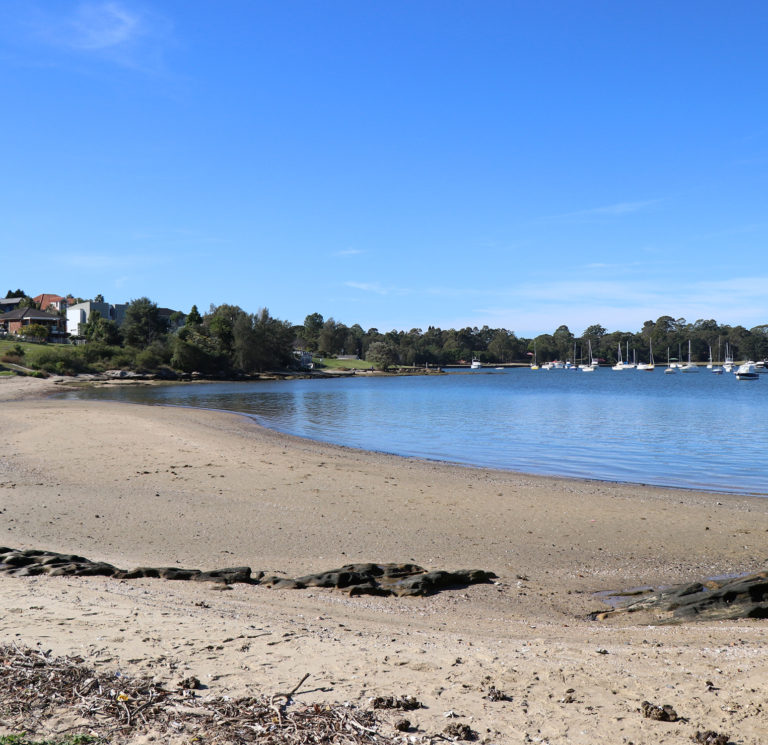
Cabarita Park is located on the Parramatta River, offering stunning water and district views. It is also home to Cabarita beach, which is currently one of four sites on the Parramatta River that is suitable for swimming. The park has plenty of shady spots, barbecues, undercover areas with picnic tables, toilets and parking, and the Rivercat wharf is just a short walk.
Cabarita Rd, Cabarita NSW 2137
Cabarita Park
Located in the scenic Cabarita Park and close to the Rivercat wharf, this large playground features a timber climbing fort, rope climbing web, swings and sandpit. The park is also home to Cabarita beach, which is currently one of four sites on the Parramatta River that is suitable for swimming.
Cabarita Rd, Cabarita NSW 2137
Cabarita Park beach
Located at the northern end of Cabarita Park, the site features a long, wide strip of sand bordered by rocks at either end. The beach is backed by beautiful parklands with picnic and BBQ facilities, a playground, public toilets and assisted access. Cabarita ferry wharf is walking distance from the park.
17 Cabarita Rd, Cabarita NSW 2137
WATER QUALITY FORECAST
| Saturday, 20 April 2024 | ||
Weather
17.7°
Showers
S 30km/h
2mm rain since 9am
|
Water QualityPollution is unlikely. Enjoy your swim! |
Tides
HT metres
at 00:00
LT metres
at 00:00 |
Cabarita Wharf
Cabarita Wharf features a 'kiss and ride' zone, covered rest area, gangway and pontoon with seating. The wharf is a short walk to the carpark and connecting bus.
Cabarita Rd, Cabarita NSW 2137
Callan Park
Located on Iron Cove in the Parramatta River, Callan Park is home to significant Aboriginal, historical, cultural, and environmental heritage. There is extensive parkland to explore on foot or by bike and the 'Bay Run' runs along the river foreshore.
Wharf Rd, Lilyfield NSW 2040
Callan Park
Callan Park is a popular recreational destination for many Inner West residents. Located on the grounds of the 60-hectare, heritage listed site in Lilyfield, it features historical buildings, extensive parkland and sporting fields. The popular Bay Run also runs through the park along the foreshore that lines Iron Cove. Callan Park has been investigated for potential swimming as part of the Parramatta River Masterplan.
Wharf Rd, Lilyfield NSW 2040
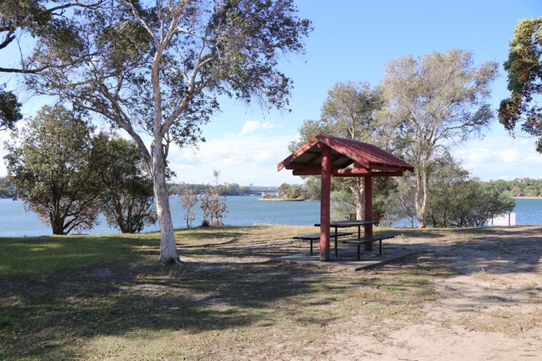
Chambers Reserve
Chambers Reserve is home to Chiswick Baths, one of the existing swimming sites on the Parramatta River. There is also a foreshore walk to Armitage Reserve, picnic shelters, barbecue, children's play equipment and scenic water views.
Bortfield Dr, Chiswick NSW 2046
Chiswick Baths
This quiet, local swimming site is enclosed by a netted enclosure and childproof fence, which is accessed via a short set of stairs. There is a shaded grass area with picnic tables and toilet facilities, and is a short walk
to Chiswick ferry wharf.
19 Bortfield Dr, Chiswick NSW 2046
WATER QUALITY FORECAST
| Saturday, 20 April 2024 | ||
Weather
17.7°
Showers
S 30km/h
2mm rain since 9am
|
Water QualityPollution is unlikely. Enjoy your swim! |
Tides
HT metres
at 00:00
LT metres
at 00:00 |
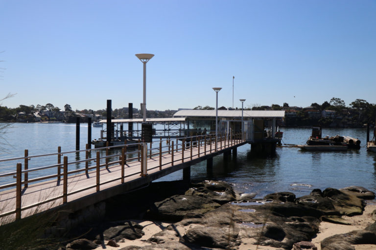
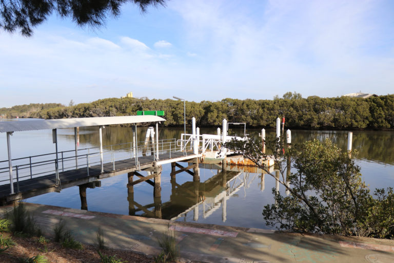
Chiswick Wharf
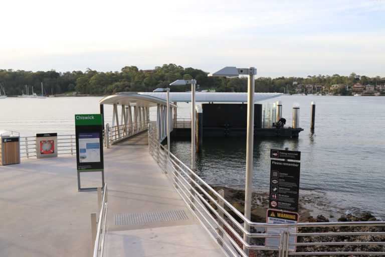
Facilities include bike racks, wheelchair access, a covered gangway and pontoon, toilets, emergency help point, hearing loop, and PA system for announcements. There is no Opal card top up or single trip ticket sales.
Bortfield Dr, Chiswick NSW 2046
City of Canada Bay
City of Canada Bay provides a range of bike paths, including The Bay Run around Iron Cove and Concord shared pathway, that enable easy access to many of the parks and reserves that line the Parramatta River foreshore.
City of Canada Bay
City of Canada Bay has a wide range of natural areas where bushcare groups work, such as estuaries with mangroves and Coastal Saltmarsh communities. Council provides support to new and existing bushcare groups and supplies training, supervision, tools, materials and equipment for their projects.
City of Canada Bay
The City of Canada Bay contains many scenic walkways and foreshore trails, including the Concord Foreshore Trail, Hen & Chicken Bay Foreshore Walk and Kokoda Track Memorial Walkway.
City of Canterbury Bankstown
City of Canterbury Bankstown has several cycle routes and shared pathways for cyclists to explore, including the popular Cooks River route. You can enjoy the many parks located along the cycleways which have great spots for barbecues and picnics.
City of Canterbury Bankstown
Bushcare volunteers in the City of Canterbury Bankstown help to remove trees and weeds, plant native vegetation and maintain wetland areas. Bushcare groups meet for about three hours each month and no experience is necessary.
City of Canterbury Bankstown
There are several walking paths to explore in the City of Canterbury Bankstown, such as the Two Valley Trail Walk.
City of Parramatta
City of Parramatta offers a wide range of cycling routes, including the Parramatta Heritage Ride and Subiaco Creek Cycleway that extends from Parramatta Park to Sydney Olympic Park.
City of Parramatta
The City of Parramatta environmental conservation program coordinates and supports volunteer groups to care for bushland reserves. Groups meet once a month and take part in a wide range of activities, including weed removal, tree planting and habitat restoration.
City of Parramatta
The City of Parramatta offers local residents and visitors a wide range of walks from exploring our colonial past in Parramatta to learning more about the biodiversity of Bicentennial Park Wetlands in Sydney Olympic Park.
City of Ryde
City of Ryde is the perfect location to ride with a wide selection of on-road and off-road cycle routes, such as the Parramatta Valley and Browns Waterhole Cycleways.
City of Ryde
The City of Ryde's bushcare program aims to regenerate, protect and preserve urban bushland areas. There are currently 20 bushcare groups operating, where you have the opportunity to learn a range of hands-on skills, including plant identification, woody weed removal, fauna observations, and water quality testing.
City of Ryde
With its leafy bushland setting and many foreshore parks, there are many walks and trails to explore, including the Gladesville Bridge to Ryde Bridge Walk and Heritage Walking Trail.
Clarkes Point Reserve
Located on the Parramatta River with stunning views of Sydney Harbour Bridge and Cockatoo Island, Clarkes Point Reserve features ample tree shade with picnic and barbecue facilities.
Woolwich Rd, Sydney NSW 2110
Cockatoo Island
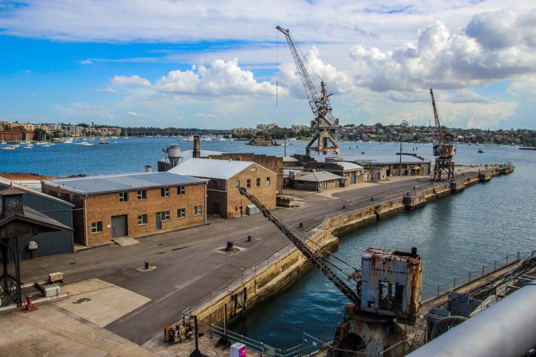
Located at the entrance to the Parramatta River, Cockatoo Island is Sydney's largest island and one of the city's most interesting historical sites. Used as a convict penal establishment and one of Australia's biggest shipyards, the island offers wide range of interesting things to see and do.
Cockatoo Island
Cockatoo Island Wharf
Facilities include a bike racks, wheelchair access, Opal card top up or single trip ticket machine, and covered pontoon.
Concord Foreshore Trail
This scenic walk extends from McIlwaine Park in the Rhodes to Majors Bay Reserve in Concord. The route covers the mangrove-fringed Brays Bay, Yaralla Bay and Majors Bay and includes the former Thomas Walker Hospital (a heritage listed building), Concord Repatriation General Hospital and the historically significant Yaralla Estate (one of the oldest estates in Sydney dating back to the 1790s).
Concord Ryde Sailing Club
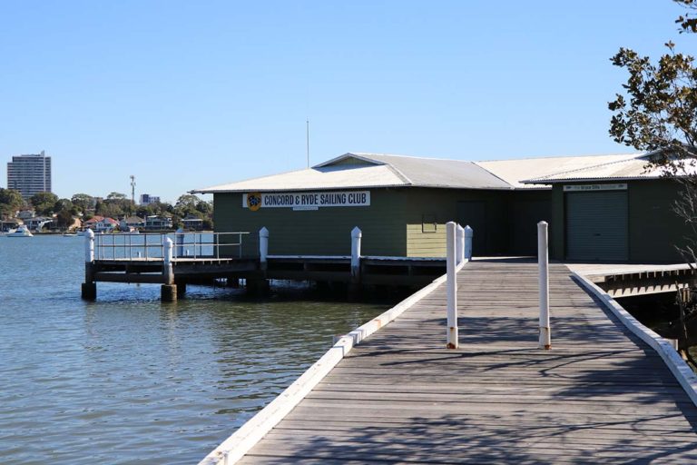
Established in 1945, the club sails on the Parramatta River between Putney and Rhodes. In addition to regular competitions, the club offers an extensive training program for children and adults.
Corner of Waterview St and Yaralla Rd, Putney NSW 2112
Cumberland Council
Many of Cumberland Council's parks and reserves, especially those that border the Duck River, are a great place for a scenic ride.
Cumberland Council
Cumberland Council works with residents and businesses to protect and enhance our local natural environment. Our volunteer bushcare groups are involved in removing weeds, planting native vegetation and maintaining woodland areas.
Cumberland Council
Many of Cumberland Council's parks and reserves, especially those that border the Duck River, provide a great place to enjoy a scenic walk.
Cumberland State Forest
As Australia's only metropolitan state forest, Cumberland State Forest offers a wide range of activities. The TreeTop Adventure Park has more than 100 elevated obstacles with rope ladders, wobbly bridges, tunnels, cargo nets and zip lines. There are also several forest walks to discover the diverse wildlife, and facilities to enjoy a relaxing picnic or barbecue.
Castle Hill Rd, West Pennant Hills NSW 2125
Dame Edith Walker Estate
The Dame Eadith Walker Estate has a distinguished history and is of significance to locals and historians alike. Home to the philanthropic Walker family for nearly 100 years, it is now used by RPA Hospital for out-patient services. With extensive grounds that reach to the water's edge, the estate is always open for the public to visit and enjoy.
Dame Edith Walker Hospital, 11D Nullawarra Ave, Concord West NSW 2138
Dawn Fraser Baths
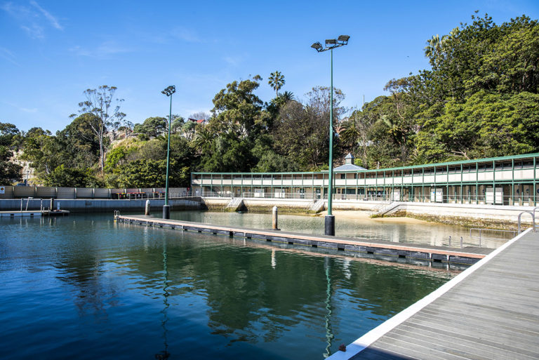
Affectionately known as 'Dawnie', Dawn Fraser Baths is home to the oldest water polo and swimming club in Australia, and listed as a nationally significant heritage site. The tidal flow saltwater baths offers both a 50m lap swimming area and beach entrance to the water. Amenities include changerooms, accessible bathrooms and a kiosk.
Fitzroy Ave, Balmain NSW 2041
WATER QUALITY FORECAST
| Saturday, 20 April 2024 | ||
Weather
17.7°
Showers
S 30km/h
2mm rain since 9am
|
Water QualityPollution is unlikely. Enjoy your swim! |
Tides
HT metres
at 00:00
LT metres
at 00:00 |
Dobroyd Aquatic Club
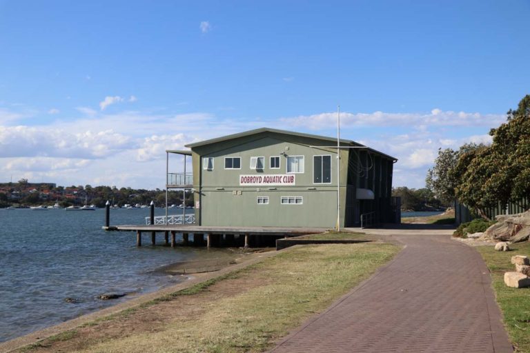
Located on Rodd Point, the club provides a safe and enjoyable venue for skiffs, dinghies and windsurfers. Members can participate in regular races every week from September to April.
Henley Marine Drive, Rodd Point NSW 2046
Domain Creek Playground, Parramatta Park
This large and diverse playground has a wide range of things to entertain kids of all ages from in-ground trampolines, a merry-go-round, spinning chair, water pumps, horizontal climbing net, musical instruments, swings, tall ‘elephant’ slide and a big birds nest swing.
Pitt St & Macquarie St, Parramatta NSW 2150
Drummoyne Oval
Drummoyne Oval offers an array of sporting and leisure opportunities from community competitions to international events.
Bayswater St, Drummoyne NSW 2046
Drummoyne Sailing Club
Drummoyne Sailing Club offers sailing opportunities for people of all ages and abilities, including 16ft skiffs, OK dinghies and yachts.
2 St Georges Cres, Drummoyne NSW 2047
Drummoyne Wharf
Facilities include wheelchair access, covered pontoon, emergency help point, hearing loop, PA system for announcements and tactile surfaces. There is no Opal card top up or single trip ticket sales.
128 Lower St Georges Cres, Drummoyne NSW 2047
Dunlop Reserve
Located next to Birkenhead Point, this local park features waterviews, children's play equipment and seats.
Birkenhead Point Outlet, Drummoyne NSW 2047
Dunlop Reserve
Located next to Birkenhead Point, this partially enclosed playground has climbing gym equipment with slides and activity stations, and seating.
Birkenhead Point Outlet, Drummoyne NSW 2047
Elkington Park
Situated on the Balmain foreshore with scenic views, Elkington Park is a popular venue for weddings. Features include lots of shaded areas, a playground and public toilets.
Glassop St, Balmain NSW 2041
Elkington Park
Situated on the Balmain foreshore and surrounded by large shade trees, this playground has swings and a climbing play gym with slides, which is located in an enclosed area with a softfall surface. There are also sheltered picnic areas and public toilets.
Glassop St, Balmain NSW 2041
Eric Mobbs Reserve
This popular reserve features playing fields, a picnic shelter and tables, barbecue and public toilets.
Ferguson Ave, Castle Hill NSW 2154
Eric Mobbs Reserve
This popular, enclosed playground includes a large climbing play gym with slides, rope wall and monkey bars. There is also a picnic shelter, barbecue and public toilets.
Ferguson Ave, Castle Hill NSW 2154
Eric Primrose Reserve Park
In addition to playing fields, the park includes a playground, outdoor exercise equipment, walking pathway and cycleway, picnic areas and barbecues.
86 John St, Rydalmere NSW 2116
Eric Primrose Reserve Park
Located close to the Parramatta River, the playground includes swings with a toddler seat, spider net climbing wall, climbing play gym with slide and shade cloths. There is also a purpose-built scooter and bike track with roundabouts and speed humps.
49 John St, Rydalmere NSW 2116
Ermington Boat Ramp
This boat ramp has a pontoon nearby, lighting, toilets and multiple parking spaces.
Wharf Rd, Melrose Park NSW 2114
Five Dock Bay Boat Ramp
Located next to Drummoyne Oval, there is a pontoon on the ramp, lighting, picnic facilities, playground, toilets, and multiple parking spaces.
Bayswater St, Drummoyne NSW 2047
Five Dock Bay Walk
This route passes through Raymond Reserve in Drummoyne, Taplin Park in Russell Park and Lysaght Park in Chiswick, covering a distance of 3.6 km.
Former Balmain Power Station Pump House
Constructed in 1934, the pump house provided the water to the Balmain Power Station, which supplied electricity to the local area until it was decommissioned in 1976.
29 Margaret St, Rozelle NSW 2039
Gazzard Park
This local playground has a small, spiral slide, rockers and spinners with a chipbark surface and seating.
176 Cooper Rd, Yagoona NSW 2199
George Kendall Riverside Park
This large park offers a wide range of amenities, including barbecues, outdoor exercise equipment, playground, a walking track and public toilets.
38 Spofforth Street, Ermington NSW 2115
George Kendall Riverside Park
This playground has swings, a climbing play gym with slide and a rocker. It is partially covered by a shade structure and has a chipbark surface.
28 Boyle St, Ermington NSW 2115
George Thornton Reserve
In addition to playing fields and a basketball half court, George Thornton Reserve includes a playground, barbecue and picnic facilities, and walking paths around the reserve.
View St, West Pennant Hills NSW 2125
George Thornton Reserve
Surrounded by trees, this playground has swings, including a bird's nest swing, slides and a rocker. There is also fitness equipment, basketball half-court, barbecue and picnic facilities, and walking paths around the reserve.
View St, West Pennant Hills NSW 2125
Glades Bay Park
Glades Bay Park is located in a bushland setting with seating and scenic views of the Parramatta River.
Gladesville Ave, Gladesville NSW 2111
Gladesville Reserve
Featuring large trees and scenic water views, this reserve has playing fields, a playground, skatepark, picnic facilities, walking paths and foreshore access.
Huntleys Point Rd, Huntleys Point NSW 2111
Gladesville Reserve
This playground has swings, a climbing play gym and separate slide. There is also seating and toilets.
Huntleys Point Rd, Huntleys Point NSW 2111
Gladesville Skatepark
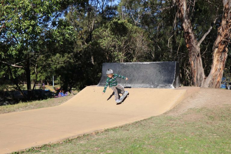
This small concrete street style park features a real jersey barrier, ledges and rails and a sculptured metal flat bank. It's a great place to learn some basic tricks.
2 Victoria Rd, Gladesville NSW 2111
Governor Phillip Walk
This walk follows the route taken by Governor Arthur Phillip when he went in search of much needed fertile land for the colony that led to the establishment of Parramatta. The route takes in many historic and naturally beautiful sites, including the Dairy Cottage and Darling Mills Creeks. The return trip 6.5 km and takes 3 hrs 15 mins.
Graf Park
A spacious local park with a playing field and children's play equipment.
George St, Yagoona NSW 2199
Graf Park
Located next to a playing field and open grass area, this playground has a large climbing play gym, swings and rockers.
George St, Yagoona NSW 2199
Halliday Park
Halliday Park contains a large, level grass area with a shaded children's playground and picnic tables that overlook the Parramatta River.
McGrath Ave, Five Dock NSW 2046
Halliday Park
Located close to the water's edge, this shaded and enclosed playground has a climbing play gym, swings, see-saw and several rockers.
McGrath Ave, Five Dock NSW 2046
Halvorsen Park
Located right on the Parramatta River foreshore, this wonderful playground has a number of nature-based play elements, including logs and sandstone blocks to climb on. There is also a bright blue climbing play gym, swings, slides, softfall surface and shade cloths.
Seamist Avenue, Ermington NSW 2115
Helene Park
Offering views of the Parramatta River and Meadowbank Wharf, Helene Park includes a picnic area, cycle path, walkway and toilets.
153 Bowden St, Meadowbank NSW 2114
Hen & Chicken Bay Foreshore Walk
Following the Parramatta River foreshore, this walk includes Battersea Park, Quarantine Reserve, Henry Lawson Park, Abbotsford and Wareemba.
Henley Baths
Henley Baths is a local swimming area nestled between residential houses. It is backed by a small reserve with some tree shade. The baths can be accessed by a set of stairs with a railing, and there is some basic bench seating and more shade along the water's edge. Visitors to the site can enjoy picturesque views of the Parramatta River.
Dick St, Henley NSW 2111
Henley Park
This large district park includes several playing fields, cricket pitch and practice nets, playgrounds, exercise track and equipment, picnic shelters and barbecue facilities.
Mitchell St & Portland Street, Enfield NSW 2136
Henley Park
This shaded and enclosed playground has a large, colourful climbing play gym with acitivity stations, accessible swing and softfall surface. There are also playing fields, a cricket pitch and practice nets, exercise track and equipment, picnic shelters and barbecue facilities.
Mitchell St & Portland Street, Enfield NSW 2136
Henry Lawson Park
Located on the Parramatta River foreshore, Henry Lawson Park features a large grass area, barbecues, picnic spots, and playground.
Abbotsford Parade, Abbotsford NSW 2046
Henry Lawson Park
Located right on the Parramatta River foreshore, this playground has bright blue climbing play gym and softfall surface. There is also a large grass area for kids to run around, barbecues and picnic spots.
Abbotsford Parade, Abbotsford NSW 2046
Heritage Trail, Baulkham Hills
The 6 km trail explores the history of Baulkham Hills and highlights the link with original landholders and the change in land use. It is an easy walk on paved paths and takes 2.5 - 3 hours to complete.
Historic Houses Walk
This walk starts at the Parramatta Rivercat Wharf and proceeds along the river to Parramatta Park. Along the way you will pass by a number of historic places, including Old Government House, Hambledon Cottage and Elizabeth Farm. The loop is 6.5 km and takes 3 hrs 15 mins.
Holyroyd Gardens Bicycle Training Track
Holroyd Gardens Nature Reserve features a bicycle training track, barbecue and picnic facilities and an adventure and accessible playground.
Homebush Bay Walk
Homebush Bay Walk travels 9.3 km from Silverwater Road bridge, Silverwater to Homebush Bay Drive, Concord West. It passes through the historical Newington, past The Brick Pit and through the Bicentennial Park Wetlands. The surface is flat and sealed. Duration is 6hr 52min return. It is great for bike riding.
Sydney Olympic Park
Horizontal Sundial
The sun dial was created to commemorate the 200th anniversary of British settlement in Australia.
Sydney Olympic Park NSW 2127
Howley Park
Howley Park is located at the end of Victoria Place in Drummoyne. Features include scenic water views, shelter and seats.
End of Victoria Place, Drummoyne NSW 2047
Hunters Hill Council
There are several cycle routes to choose from, including the Hunters Hill Bike Route and Children's cycle track in the Buffalo Creek Reserve. Council is also in the process of developing a system of cycleways which, when complete, will link Hunters Hill to Lane Cove, Ryde and Canada Bay.
Hunters Hill Council
Hunters Hill Council's bushcare volunteer program supports habitat conservation for native animals, removal of exotic weeds and protection of stream banks from erosion. There are currently 10 bushcare groups and almost 70 active volunteers operating in the Hunters Hill area.
Hunters Hill Council
Known as the 'garden suburb', Hunters Hill has a great variety of walking tracks that stretch between the Parramatta River and the Lane Cove River.
Hunters Hill Heritage Walks
Hunters Hill offers history buffs many opportunities to explore the area's rich heritage
Hunter’s Hill Sailing Club
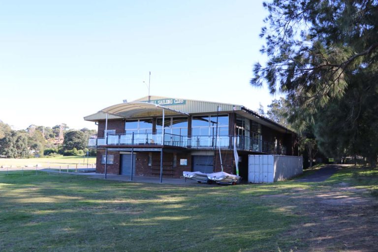
Established in 1961, the volunteer-run sailing club focuses on introducing people of all ages, but particularly children, to sailing. With spectacular views of the Parramatta River and Sydney Harbour, the club is a popular place for weddings and other functions.
Clarke Rd, Woolwich NSW 2110
Huntleys Point Wharf
Facilities include bike racks, covered pontoon, emergency help point, hearing loop, PA system for announcements and tactile surfaces. There is no Opal card top up or single trip ticket sales.
Huntley's Point Rd, Henley NSW 2111
Inner West Council
The Inner West has a wide range of cycling routes that stretch from bustling Newtown to the Parramatta River foreshore in Callan Park, Lilyfield.
Inner West Council
Inner West Council currently manages 11 bushcare sites. The bushcare program will provide you with practical skills and experience in native plant identification, weed control management and building and protecting habitats for native wildlife. No experience is required and a site supervisor will help you get started and provide gloves, tools and morning tea.
Inner West Council
Whether you're interested in the local history or just want to keep fit, the Inner West has a wide range of walking routes, including the Balmain Historical Walking Tour and popular Bay Run.
International Peace Park
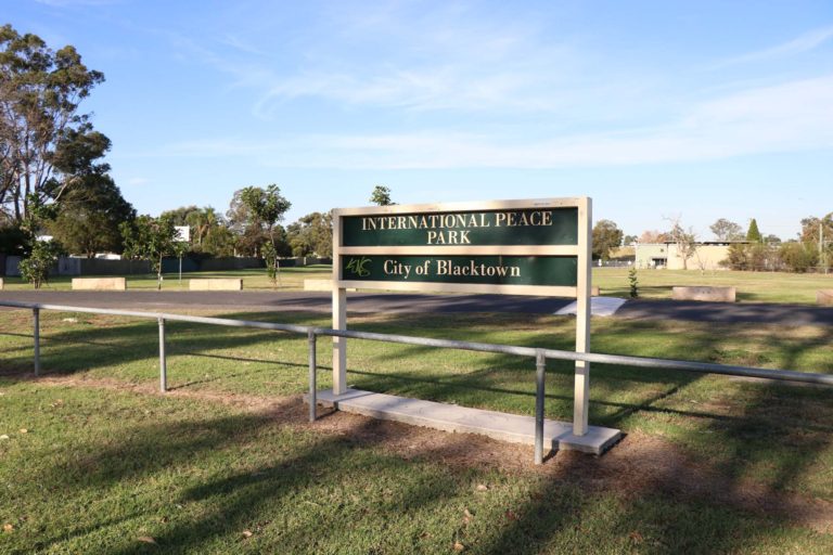
This well-known, local park features a large grass area and plenty of space for kids to run around or kick a ball.
Rowley Street, Seven Hills 2147
Kelly’s Bush Park
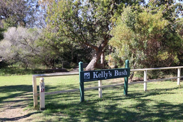
Kelly's Bush Park is the only remaining patch of bushland on the western side of the lower Parramatta River. The park includes walking paths, foreshore access, a lookout and scenic views of the Parramatta River.
Nelson Parade, Hunters Hill NSW 2110
King George Park
King George Park is located near the Iron Cove Bridge and is part of the 'Bay Run'. Amenties include an outdoor fitness station, playground, barbecues and public toilets.
Manning St, Rozelle NSW 2039
King George Park
Located next to the Bay Run in Rozelle, this space-themed playground offers a wide range of equipment from slides, climbing rope tower, flying fox, tripod swing and sandpit. There is also a small, sandy beach to explore as well as barbecues, picnic tables, exercise equipment and toilets.
Manning St, Rozelle NSW 2039
Kissing Point Park
Located on the Ryde Riverwalk in a beautiful bushland setting, Kissing Point Park has barbecue and picnic facilities, a playground, accessible toilets, parking and boat ramp. There is also a sandy beach near the Rivercat wharf. Kissing Point has been investigated for potential swimming as part of the Parramatta River Masterplan.
Waterview St, Putney NSW 2112
Kissing Point Park
Overlooking the Parramatta River and surrounded by trees, this playground has a climbing play gym, toddlers' climbing and activity equipment, rocker, spinner and softfall surface.
Waterview St, Putney NSW 2112
Kissing Point Park
Kissing Point is located on the Ryde River Walk, and is close to the Kissing Point Rivercat Wharf, boat ramp, playground, carpark and toilet facilities. The park is bordered by a long, sandy beach and is a popular place for a wide range of water sports. Kissing Point has been investigated for potential swimming as part of the Parramatta River Masterplan.
Dyson St, Putney NSW 2112
Kissing Point Park Boat Ramp
This boat ramp has lighting, toilets, multiple parking spaces, playground, picnic and barbecue facilities.
Delange Rd, Putney NSW 2112
Kissing Point Wharf
Facilities include wheelchair access and car space, commuter car park, bike lockers, covered pontoon, emergency help point, hearing loop, PA system for announcements and tactile surfaces. There is no Opal card top up or single trip ticket sales.
Waterview St Putney NSW 2112
Kokoda Track Memorial Walkway
The Kokoda Track Memorial Walkway covers more than 800 metres from Rhodes Station to Concord Hospital and runs along the mangrove-lined shores of Brays Bay. The walk features 22 stations or plaques that describe a significant place or engagement, and lush tropical vegetation that simulates the conditions of The Kokoda Track. There is a cafe, picnic facilities, children's playground and toilets.
Killoola St, Concord West NSW 2138
Lake Circuit Walk
A circuit loop through 75 ha of pristine remnant bushland that circles the 11 ha man-made lake. The walk covers a distance of 4.3 km over natural earth and rock shelves which crosses two creek tributaries. Duration is a 1 hr 55 mins loop. Impassable in wet weather. There is access to a cafe, barbecue and picnic facilities and toilets.
Illawong Drive, North Parramatta NSW 2151
Lake Parramatta Reserve
Lake Parramatta was officially reopened for public swimming and water recreational activities in 2015. This popular site features a designated swim area that is patrolled by lifeguards from late October to late March. Other amenities include non-motorised boat hire, walking trails, a children’s playground, BBQ and picnic areas, and a cafe that is open on weekends.
28 Bourke St, North Parramatta NSW 2151
WATER QUALITY FORECAST
| Saturday, 20 April 2024 | ||
Weather
17.7°
Showers
S 30km/h
2mm rain since 9am
|
Water QualityClick here for information on water quality |
TidesUnmonitored |
Leichhardt Park
Leichhardt Park runs along the Parramatta River foreshore and features the popular 'Bay Run'. Amenities include playing fields, playground and seniors' outdoor fitness station. It is also home to the Leichhardt Park Aquatic Centre.
Lilyfield NSW 2040
Leichhardt Rowing Club
Located in Lilyfield, the community-based rowing club offers opportunities for recreational and competitive rowers of all ages.
62 Glover St, Lilyfield NSW 2040
Leichhardt Walking Tour
This easy walk extends from Parramatta Road to Pioneers Memorial Park and takes in several well-known landmarks, including the fire station, All Souls Church and Town Hall.
Lennox Bridge
Constructed from 1836-39, Lennox Bridge was designed by David Lennox, who was a pioneer in bridge building in Australia. The bridge provides a great vantage point to view the Parramatta River.
Parramatta River, Parramatta NSW 2150
Little Coogee, Parramatta Park

Located in Parramatta Park, Little Coogee features a tree-lined grassy riverbank that offer many places to enjoy a relaxing picnic. The site was once a very popular swimming and picnic spot, and home to the 1914 Olympic Carnival. In the future, there may be more opportunity for people to engage with the river's edge and its natural areas.
Parramatta NSW 2150
Little Coogee, Parramatta Park
Little Coogee is located on the Parramatta River in in Parramatta Park. The site was a very popular swimming and picnic spot as far back as the 1880s, and was home to the Olympic Carnival of 1914, amongst other events. The tree-lined, grassy riverbank provides many places to relax and enjoy the tranquil environment. Whilst swimming is currently not being considered, there is future opportunity for land-based and river bank activity.
Parramatta NSW 2150
Lysaght Park
Lysaght Park is a large, open grass area located on the Parramatta River in Chiswick. Facilities include play equipment, picnic tables, undercover areas and wheelchair access
7P Bibby St, Chiswick NSW 2046
MacArthur St Bridge
The Macarthur St Bridge site is a narrow reserve on the southern side of the Parramatta River. There is ample tree shade providing lots of places to enjoy a relaxing picnic. The park is walking distance to the Parramatta Rivercat wharf and is part of the Harris Park Heritage Walk. Whilst swimming is currently not being considered, there is future opportunity for land-based and river bank activity.
Parramatta NSW 2150
Majors Bay Reserve
Home to the 'Concord Comets' baseball team, this park includes a playground, dog off-leash area and water views.
Cnr Norman and Nullawarra Avenues, Concord NSW 2137
Majors Bay Reserve
Surrounded by several playing fields, this playground has a climbing play gym, slide and small rock climbing wall.
Cnr Norman and Nullawarra Avenues, Concord NSW 2137
Maluga Passive Park
This charming park features a large freshwater pond that is home to a wide range of birds and other wildlife. There is also a fenced playground, fitness equipment, picnic tables, barbecues, walking paths and toilets.
Cascoigne Road, Birrong NSW 2143
Maluga Passive Park
Located in the centre of this scenic park, the playground has a large climbing play gym, swings and softfall surface. There is also fitness equipment, picnic tables, barbecues, walking paths and toilets.
Cascoigne Road, Birrong NSW 2143
Mason Park
Located next to Powells Creek, this popular park includes playing fields, a playground and toilets. There is also access to the walking and cycling path that leads to Sydney Olympic Park.
Underwood Rd, Homebush NSW 2140
Mason Park
This playground has colourful climbing play gym, swings, softfall surface and shade structure.
Underwood Rd, Homebush NSW 2140
McIlwaine Park
McIlwaine Park is located in Rhodes and looks out onto Brays Bay. The park is a very popular recreation spot with picnic tables, barbecues, toilets, play equipment and parking.
Concord Rd, Rhodes NSW 2138
McIlwaine Park
Overlooking Brays Bay this large, partially covered playground has a climbing play gym with multiple slides and sandpit. There is also a smaller, enclosed playground with boat-themed climbing play gym, rockers and spinners. Other facilities include picnic tables, barbecues, toilets, and parking.
City of Canada Bay Council is currently working on the $5 million McIlwaine Park foreshore upgrade and Brays Bay river access project, which is due to be completed in 2024.
Concord Rd, Rhodes NSW 2138
Meadowbank Park
Meadowbank Park is a major sporting and recreation area. In addition to playing fields, netball hard courts and tennis courts, there are playgrounds, and walking and cycling paths as part of the Ryde Riverwalk.
Constitution Rd, Meadowbank NSW 2114
Meadowbank Park
Meadowbank Park features several playgrounds that offer a wide range of play equipment including climbing play gyms, climbing walls, swings, slides and rockers. Some of the playgrounds are enclosed with a softfall surface and covered by a shade structure.
Constitution Rd, Meadowbank NSW 2114
Meadowbank Wharf
Facilities include a 'kiss and ride' zone, wheelchair access, commuter car park, bike lockers, Opal card top up or single trip ticket machine, covered pontoon, toilets, emergency help point, hearing loop, and PA system for announcements.
Bowden St, Meadowbank NSW 2114
Melrose Park
Located along the Ryde River Walk, the park includes grass areas, a fenced playground with shade cloth, barbecue facilities, toilets and parking.
86 Lancaster Avenue, Melrose Park 2114
Melrose Park
The centrepiece of play equipment at this park is a wooden beam and rope climbing frame with slides. Beside it is a fun water pump with channels carved out of sandstone blocks. There are also two swings, a wood chip base and some natural shade over the playground.
90 Lancaster Ave, Melrose Park NSW 2114
Memorial Park
Memorial Park is located in a leafy bushland setting with views of Parramatta River. It features barbecue and picnic areas, playground and walking paths.
Meadowbank Cres, Meadowbank NSW 2114
Memorial Park
Located in a leafy bushland setting with views of the Parramatta River, the playground features a timber climbing play gym with multiple slides and swings.
Meadowbank Cres, Meadowbank NSW 2114
Memorial Park, Meadowbank
This site is located on the foreshore of Memorial Park, There is a small sandy beach and access to barbecue and picnic areas, playground and walking paths. Kissing Point has been investigated for potential swimming as part of the Parramatta River Masterplan.
Meadowbank Cres, Meadowbank NSW 2114
Mill Park
This local foreshore park features outdoor fitness equipment, public toilets, cycleway, walkway and waterviews.
2 Mill Park Street, Rhodes NSW 2138
Millennium Parklands
Wetlands, scenic hills and forests make the Millennium Parklands a great place for a ride, walk or jog.
Wentworth Point NSW 2127
Mona Park
Mona Park is located adjacent to the Duck River and has extensive amenities, including a children’s playground, learn to cycle area and cricket practice nets.
27A Chisholm Rd, Auburn NSW 2144
Mona Park
Located near the Duck River, this playground has a rope climbing structure, swings and softfall surface.
27A Chisholm Rd, Auburn NSW 2144
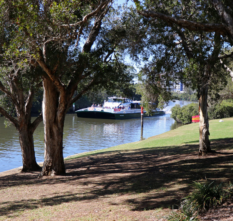
Mortlake Ferry (Mortlake side)
Commonly known as the ‘Putney punt’ the Mortlake ferry opened in 1925 and is one of the only remaining punts in Sydney. It crosses the Parramatta River from Hilly Street, Mortlake to Pellisier Road, Putney. The ferry can carry 18 cars with a safe load limit of 90 tonnes.
Hilly Street, Mortlake NSW 2137
Mount Wilberforce Lookout
Located in a scenic bushland setting, the park features a lookout with walking tracks, picnic area, barbecues and toilets.
7 Castle Hill Rd, West Pennant Hills NSW 2125
Mt Wilberforce Lookout Reserve
Located in a bushland setting, the children's playground features a colourful climbing gym, spinner and swings.
7 Castle Hill Rd, West Pennant Hills NSW 2125
Narrawang Wetland
Make your way along the paths and a reed-fringed boardwalk to observe the habitat that supports a colony of the endangered Green and Golden Bell frogs and other frog species.
Neild Park
The park features four playing fields, a cafe, toilets and easy access to the Parramatta River foreshore.
Nield Ave, Rodd Point NSW 2046
Newington Armory
From its military-industrial origins, Newington Armory has developed into a unique arts precinct that includes an outdoor amphitheatre, theatre, exhibition space and artist studios.
Sydney Olympic Park NSW 2127
Old Government House
Built by convicts from 1799-1816, Old Government House was the country residence for the first 10 governors of the colony. It now houses the nation’s premier colonial furniture collection.
1A Pitt St, Parramatta NSW 2150
Parklands Circuit
This 5.5 km circuit starts in the tranquil atmosphere of Bicentennial Park and takes in the picturesque Lake Belvedere, Badu Mangroves boardwalk, Bird Hide and Waterbird Refuge. Be sure to look out for the historic ship wrecks that now rest in the bay. Duration is 60 mins.
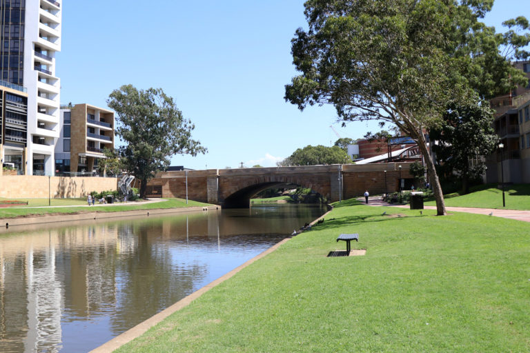
Parramatta CBD
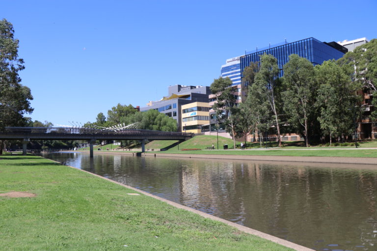
The Parramatta River foreshore reserve runs along the river’s edge close to the Parramatta CBD. It is a popular location for city workers, shoppers and cyclists. The site is home to a range of significant festivals and events such as the Loy Krathong Holiday and Paddle Festival. It is also used for recreational boating including canoe polo events. With the continuing development of Parramatta CBD, there is huge potential for further riverfront activation.
Parramatta NSW 2150
Parramatta Heritage Ride
The Parramatta Heritage Trail is an easy cycle loop, conveniently located near the Parramatta Train Station. History buffs will enjoy riding past some of the city’s oldest buildings, including Old Government House.
Parramatta Heritage Trail
The Parramatta Heritage Trail is an easy cycle loop, conveniently located near the Parramatta Train Station. History buffs will enjoy riding past some of the city’s oldest buildings, including Old Government House.
Parramatta Park
Covering more than 99 hectares, Parramatta Park features a wide range of things to do and see from historical tours to walking and cycling or enjoying one of the many scenic picnic and barbecue areas.
Pitt St & Macquarie St, Parramatta NSW 2150
Parramatta River Foreshore Park
Located right on the river foreshore, this park has a wide range of fun activities to keep kids entertained, including a long slide, sandpit with inbuilt pulleys and scoopers and a water play area. There is also a tilted climbing wall, smaller wide slide, rope bridge and rope climbing wall.
Elizabeth St Parramatta NSW 2150
Parramatta Regional Park
Located on the Parramatta River, this park features walking paths, boat jetty, a small sandy beach and scenic district and water views.
Campbell Drive, Gladesville NSW 2111
Parramatta River Walk
This walk begins and ends at Rhodes Station with access points at various stages along the route. Estimated walking time 5-6 hours and involves a river crossing by ferry and one by train.
Parramatta Valley Shared Cycleway
The Parramatta Valley Shared Cycleway commences at the Parramatta Ferry Wharf and continues east into Ryde Council’s walking and cycleway network along the edges of Parramatta River. It is an easy walk which takes in the Baludarri Wetland and Ermington Bay Nature Trail. The Parramatta City Council section is 8.2 km and 6 hrs 5 mins return.
Parramatta to Meadowbank
Parramatta Valley Shared Cycleway
The Parramatta Valley Shared Cycleway commences at the Parramatta Rivercat Wharf and continues east into Ryde Council’s walking and cycleway network along the edges of Parramatta River. It is an easy walk which takes in the Baludarri Wetland and Ermington Bay Nature Trail. The Parramatta City Council section is 8.2 km and 6 hrs 5 mins return.
Parramatta Valley Shared Cycleway
The Parramatta Valley Shared Cycleway commences at the Parramatta Rivercat Wharf and continues east into Ryde Council’s walking and cycleway network along the edges of Parramatta River. It is a mostly flat path which takes in the Baludarri Wetland and Ermington Bay Nature Trail. The full route is 15 km long.
Parramatta Wharf
Upgraded in 2019, the Parramatta Wharf includes a covered pontoon, wheelchair accessible toilet and car space, bike racks and lockers, Opal card top-up or single trip ticket machine, kiss and ride stopping area and taxi rank.
Parramata NSW 2150
Peace Monument
The Peace Monument is a metal sculpture commissioned by the NSW Government in 1986 to commemorate the United Nations International Year of Peace.
Australia Ave, Sydney Olympic Park NSW 2127
Pearce Reserve
Surrounded by a large grass area, the playground includes swings and a colourful, climbing play gym.
Joseph Banks Drive, Kings Langley 2147
Pearce Reserve
This scenic park features a large grass area, cricket pitch, walking paths, covered picnic tables and a children's playground.
Joseph Banks Drive, Kings Langley 2147
Pemulwuy Loop
Named after Pemulwuy (c.1750-1802), a Darug First Australian man who led the resistance against the Europeans spreading west from Sydney Cove, this walk takes in the Toongabbie and Quarry Branch Creeks. Covering 5.4 km, with a duration of 2 hrs 25 mins, the track surface is a mixture of natural earth as well as rock and wooden stairs.
Point Road Park
Point Road Park is located at Callan Point between Callan Park and King George Park. Features include a small, sandy beach, tree shade, grass area and spectacular views of the Parramatta River and Iron Cove Bridge. There are also significant (non-Aboriginal) 19th century rock carvings that highlight the area's maritime history.
Point Road Rozelle NSW 2039
Prince Edward Park
A popular location for weddings, this scenic park features barbecue facilities, a small playground and public toilets.
Rosemeadow Drive, Cabarita NSW 2137
Prince Edward Park
Located close the water's edge and surrounded by trees, this playground has a boat-shaped fort, small climbing rope tower, rockers, swings, and a maze.
Rosemeadow Drive, Cabarita NSW 2137
Prowse Reserve
This local park includes a grass area, tree shade, covered playground and smaller enclosed area with play equipment for younger children.
Royce Ave, Croydon NSW 2132
Prowse Reserve
This local playground has a climbing play gym with activity stations, swings, shade shelter and softfall surface. There is also an enclosed playground for toddlers.
Royce Ace, Croydon NSW 2132
Pulpit Point Reserve
This scenic waterfront park features a large, gentle sloping grass area, tree shade and panoramic views of the Parramatta River and Sydney Harbour Bridge.
Le Vesinet Dr, Hunters Hill NSW 2110
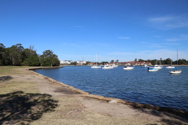
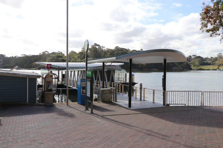
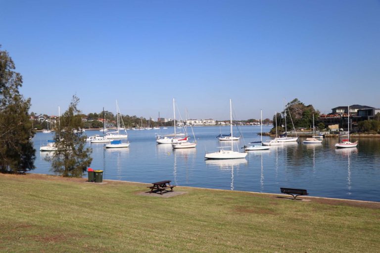
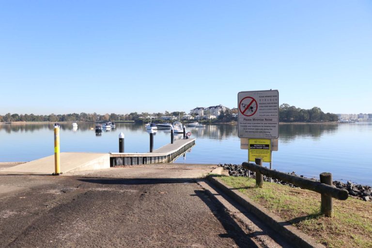
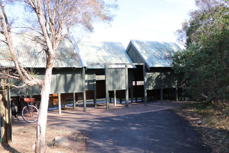
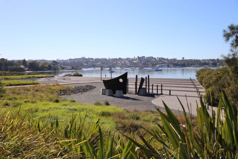
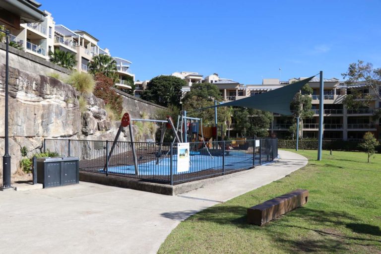
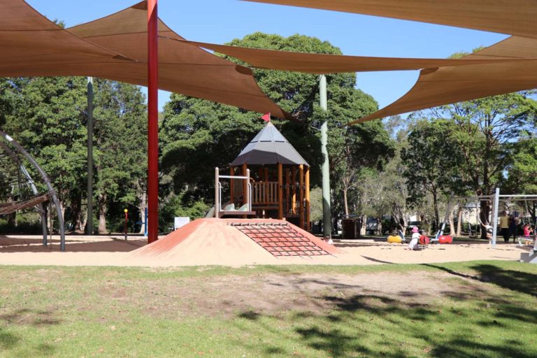
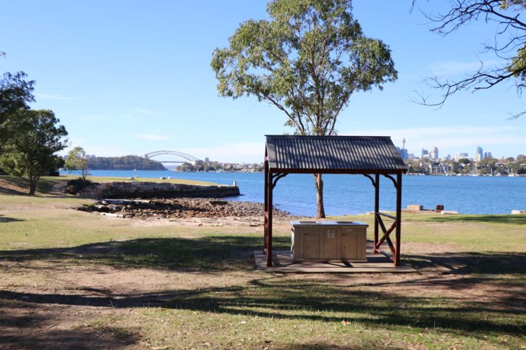
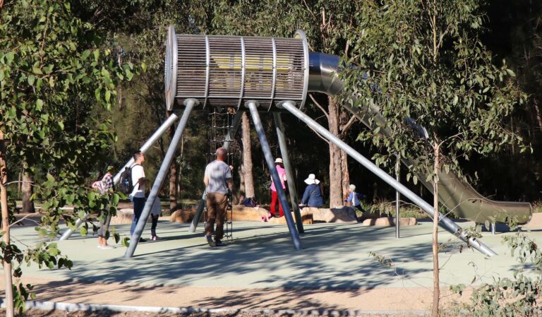
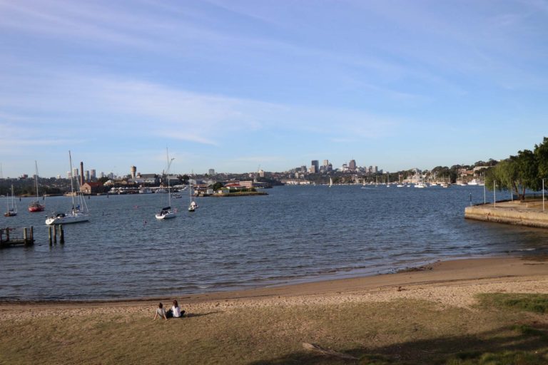
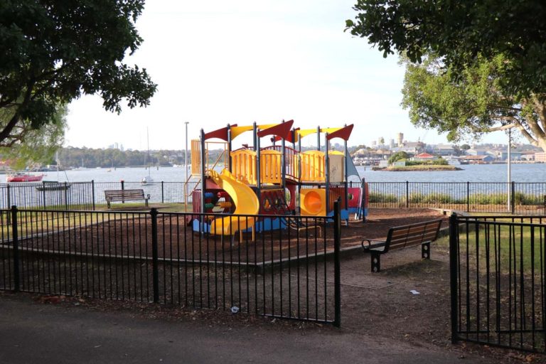
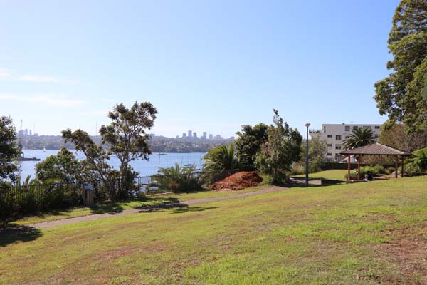
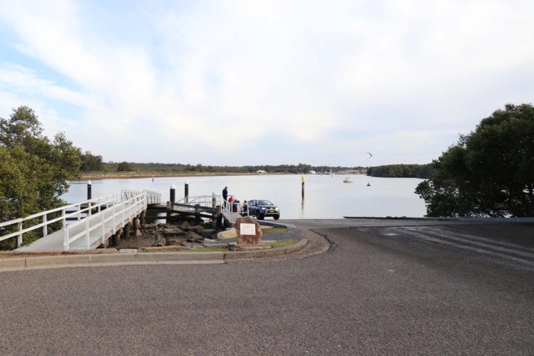
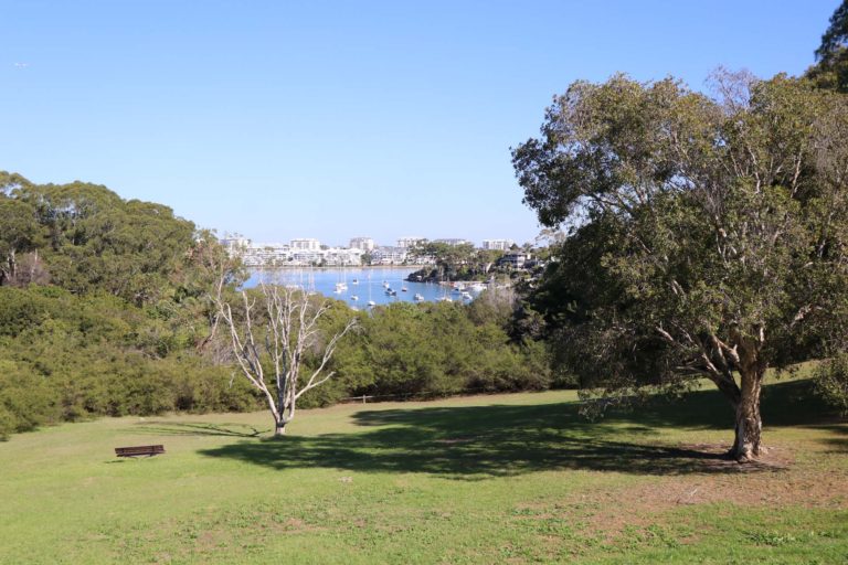
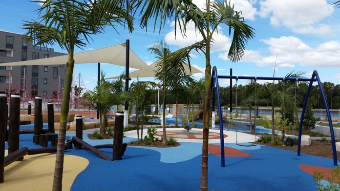
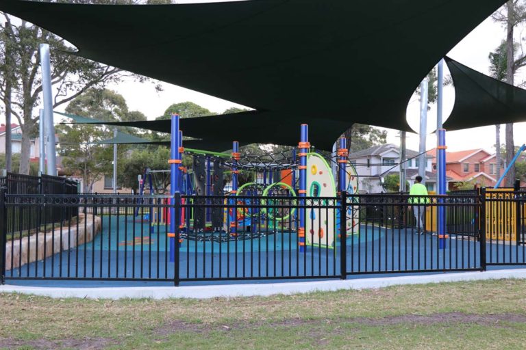
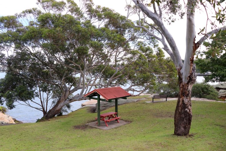
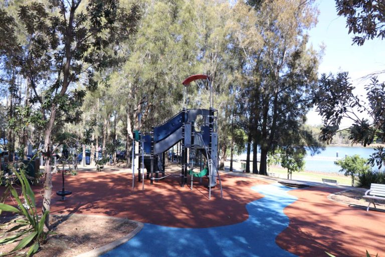
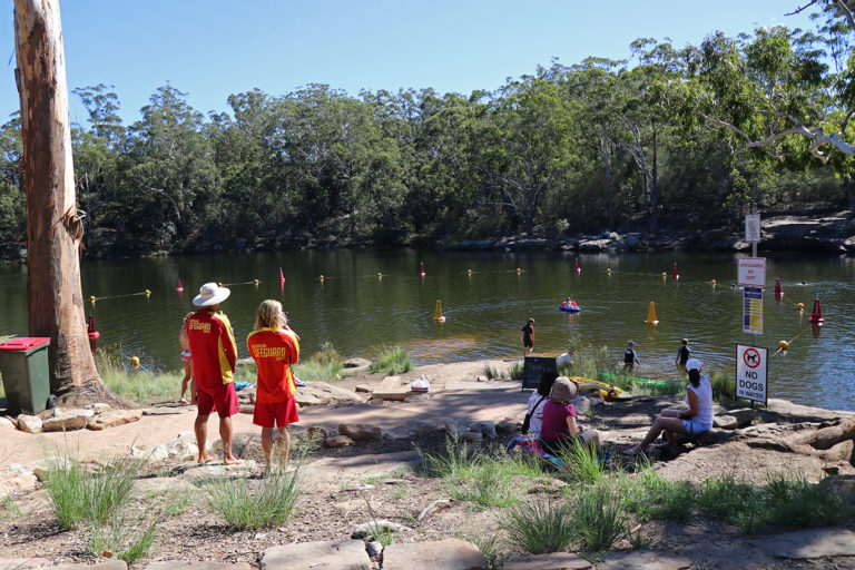
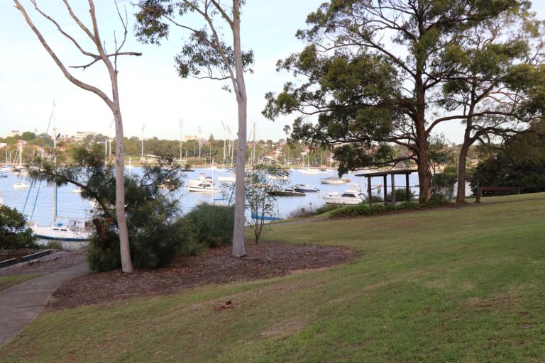
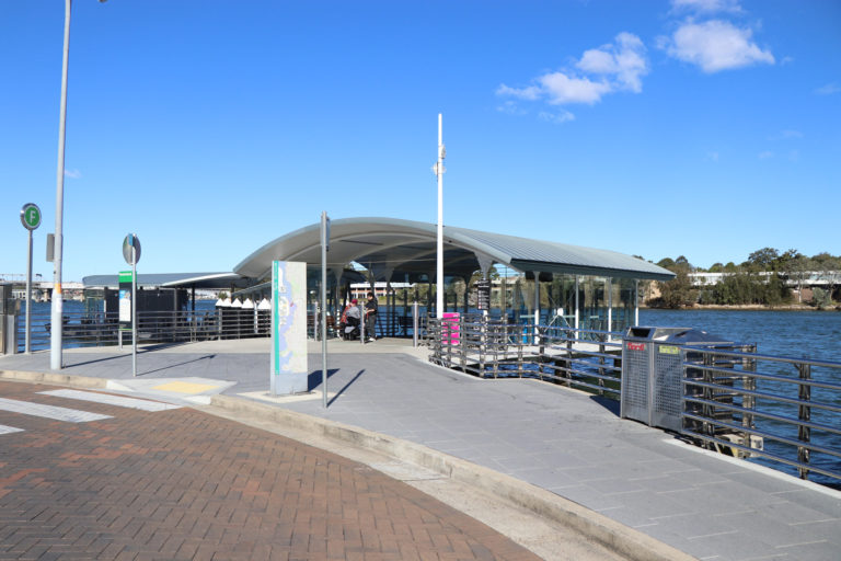
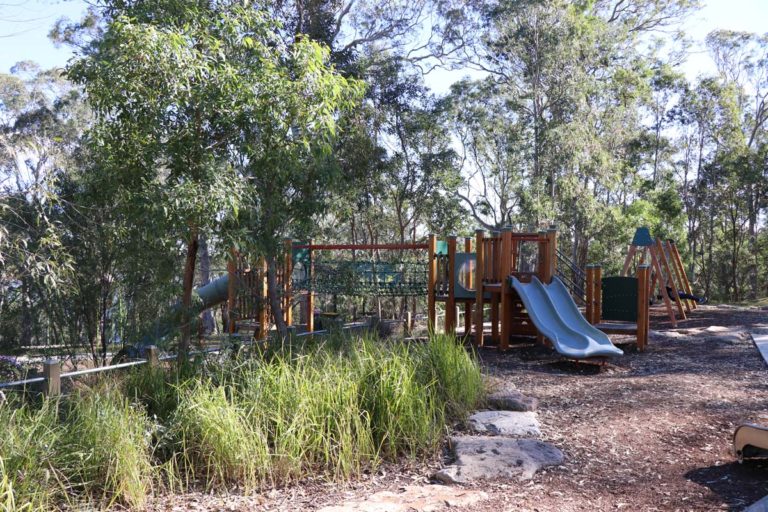
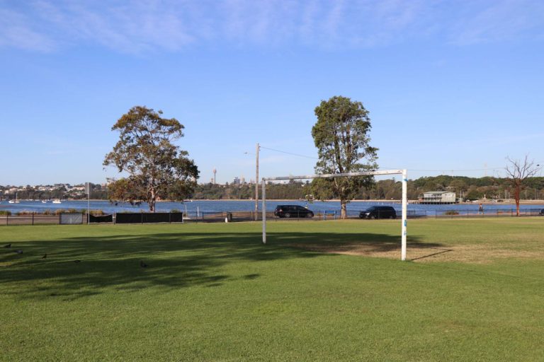
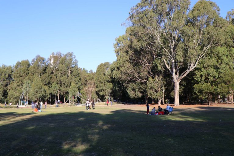
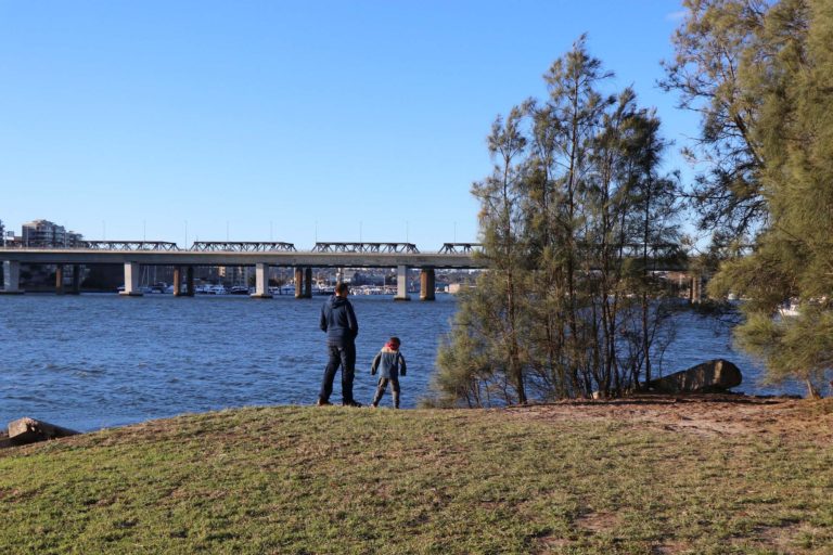
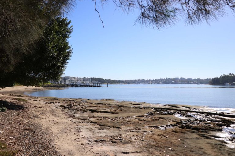
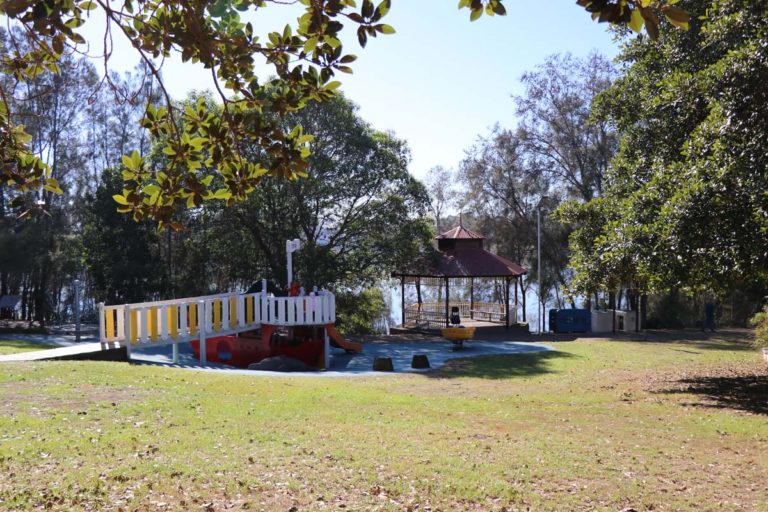
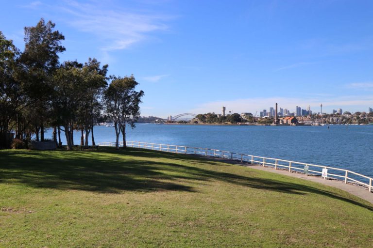
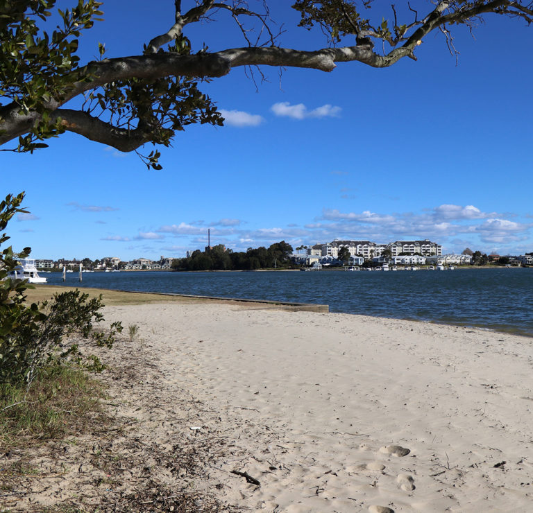
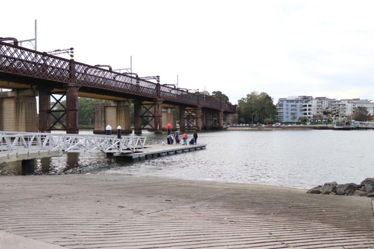
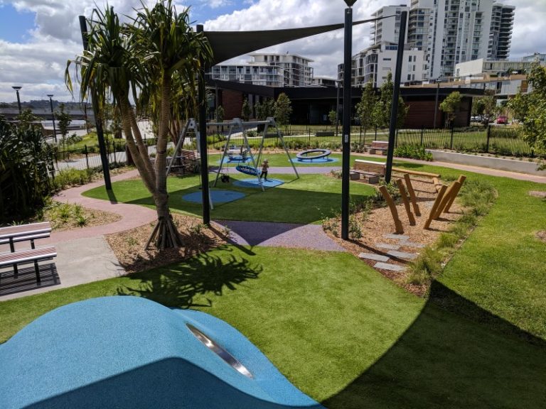
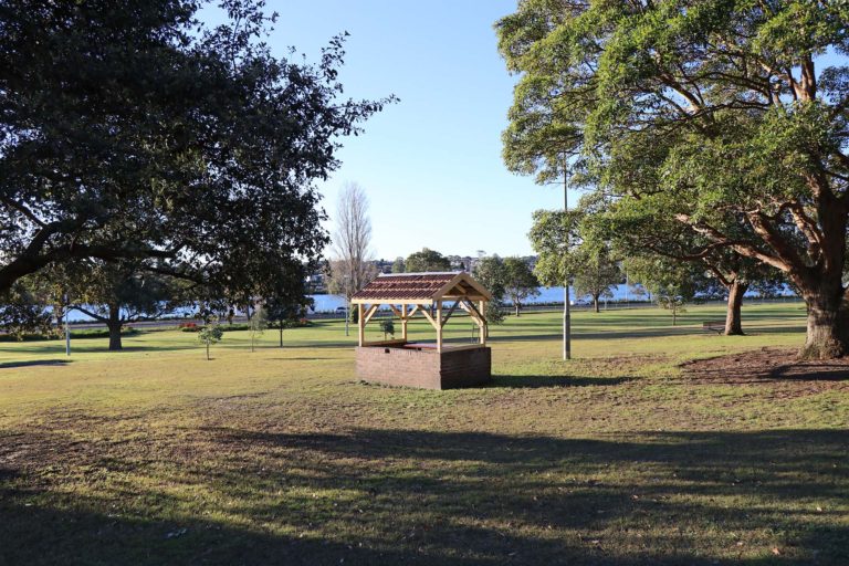
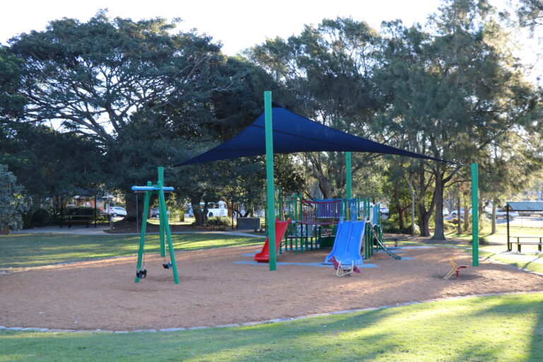
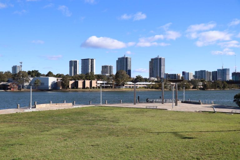
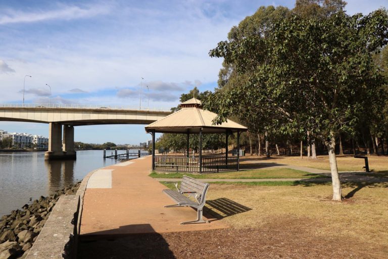
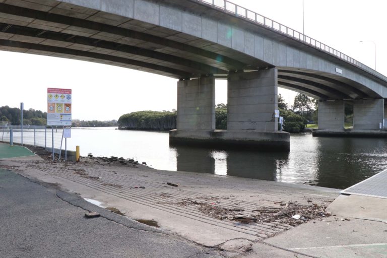
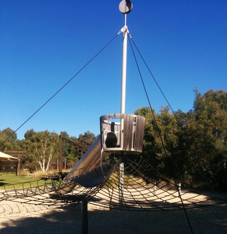
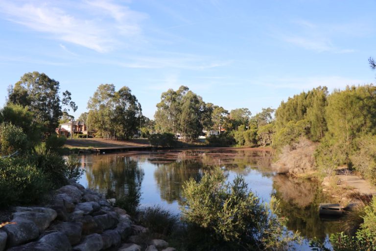
Putney Park
Located right on the water, Putney Park is a great place for group events. Features include extensive grass and natural areas, barbecue and picnic facilities, and a large playground with water features. Putney Park has been investigated for potential swimming as part of the Parramatta River Masterplan.
Pellisier Rd, Putney NSW 2112
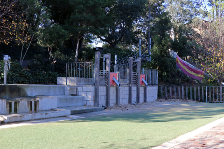
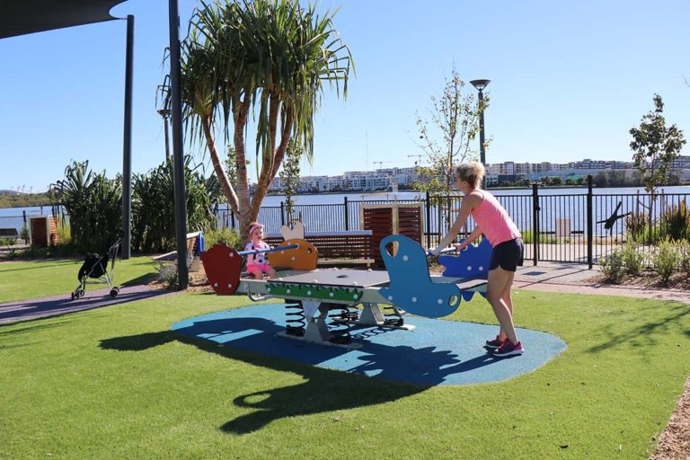
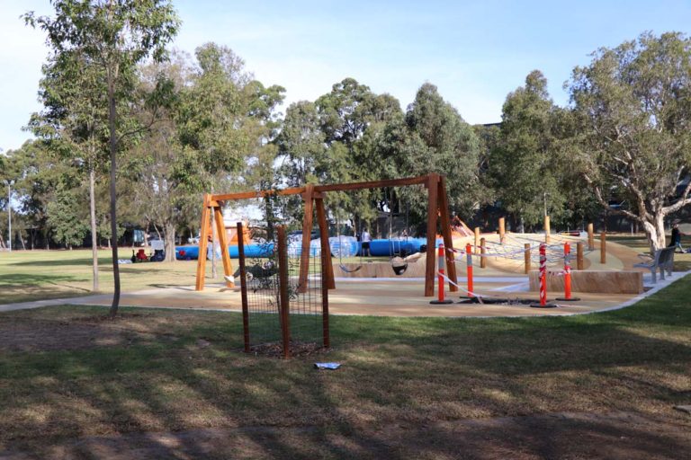
Putney Park
Located close to the river foreshore, the main playground features a large, metal platform with a long, tunnel slide, two splash pools and an assortment of colourful shapes for children to climb on. There is also a separate playground with a rope climbing tower, climbing play gyms, swings and rockers. Putney Park has been investigated for potential swimming as part of the Parramatta River Masterplan.
Pellisier Rd, Putney NSW 2112
Putney Park
Putney Park features extensive grass and natural areas, BBQ and picnic facilities, several playgrounds and ample parking. In 2021, City of Ryde built a new seawall and stairs to provide access to the river foreshore and beach area at low tide. Planning is currently underway for the construction of a swimming enclosure. Water quality monitoring is being conducted by Sydney Water’s RiverWatch program, and the site is expected to open in late 2023.
Pellisier Rd, Putney NSW 2112
WATER QUALITY FORECAST
Sorry, live data is not available at this time.Please check back later.
Putney Park
Located close to the river foreshore, the main playground features a large, metal platform with a long, tunnel slide, two splash pools and an assortment of colourful shapes for children to climb on. There is also a separate playground with a rope climbing tower, climbing play gyms, swings and rockers. Putney Park has been investigated for potential swimming as part of the Parramatta River Masterplan.
Pellisier Rd, Putney NSW 2112
Quarantine Reserve
This secluded, waterfront park includes a large grass area, covered picnic shelter and toilets. There is also a sandy beach with tree shade. Quarantine Reserve has been investigated for potential swimming as part of the Parramatta River Masterplan.
50 Spring St, Abbotsford NSW 2046
Quarantine Reserve
This site features a secluded, sandy beach with tree shade. There is also a large grass area overlooking the water, a covered picnic shelter and toilets. Quarantine Reserve has been investigated for potential swimming as part of the Parramatta River Masterplan.
Spring St, Abbotsford NSW 2046
Queen’s Wharf Reserve
Part of the Harris Park Heritage Walk, this foreshore park includes a gentle sloping grass area and plenty of tree shade for a relaxing picnic. It's also a short walk to the Parramatta Rivercat wharf.
George St, Parramatta NSW 2150
Ray Marshall Reserve
Bordering Duck River, this spacious park features playing fields, picnic and barbecue facilities, walking path and children's play equipment. It's also a short stroll to the Auburn Botanic Gardens and Peacock Gallery.
2a Erie St, South Granville NSW 2142
Ray Marshall Reserve
Overlooking Duck River, this playground has a climbing play gym with activity stations and slides. Further along the river there is a separate, covered play area with a climbing frame.
2a Erie St, South Granville NSW 2142
Rhodes Boat Ramp
There is a pontoon on the ramp, lighting and 14 car spaces.
Blaxland Rd, Rhodes NSW 2138
Rhodes Foreshore Park
Overlooking Homebush Bay, this park features an enclosed and shaded playground, grass area, seating and wlaking path. It is also close to The Connection community centre and cafes.
Shoreline Dr, Rhodes NSW 2138
Rhodes River Foreshore Park
Located near the water's edge, this enclosed and shaded playground has lots of colourful equipment including a birds nest swing, see-saw, climbing mound and spinning disc.
Shoreline Dr, Rhodes NSW 2138
River Foreshore Reserve
Located along the northern and southern banks of Parramatta River, this reserve features a bike path, playground and picnic facilities.
Elizabeth St, Parramatta NSW 2150
River Heritage Circuit
Situated along the Parramatta River, this circuit takes in several significant historic and natural sites, including the naval heritage precinct, Newington Amory, scenic wetlands, and the suburb of Newington, which was the former athletes' village of the Sydney 2000 Games. Distance is 11 km and duration is 70 mins.
Riverside Walks, Sydney Olympic Park
Join this circuit walk at the gates to Newington Armory that includes the Parramatta River foreshore, Newington Nature Reserve, historic Armory wharf and the lookout at Blaxland Riverside Park.
Robson Park
This scenic local park features a large grass area, picnic facilities, playground and water views.
Haberfield NSW 2045
Robson Park
This popular local playground features a climbing play gym with multiple slides, swings, shade cloth and sandy surface. There is also a large grass area, barbecues and picnic tables.
Haberfield NSW 2045
Rodd Park
Popular as a wedding venue, this scenic park features barbecue and picnic facilities, toilets, and plenty of shady spots to enjoy a relaxing day out.
86P Henley Marine Dr, Rodd Point NSW 2046
Rydalmere Wharf
Upgraded 2019, the wharf now includes a new covered pontoon, wider accessible path, and 'kiss and ride' zone.
John St, Rydalmere NSW 2116
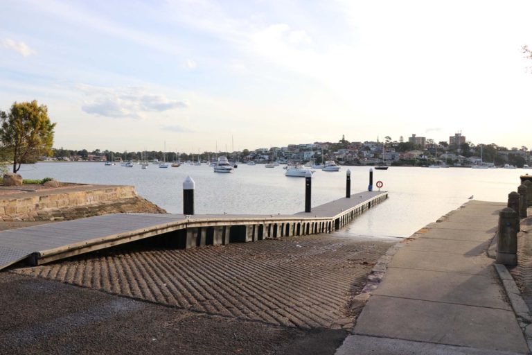
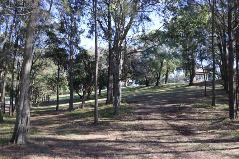
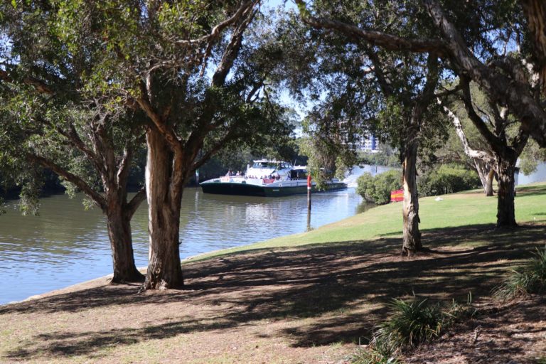
Ryde Riverwalk
This 12 km long pathway follows the Parramatta River, between Kissing Point Park and Melrose Park, showcasing the foreshore and its historic and cultural significance to the area. The Ryde Riverwalk is designed for use by walkers and cyclists and connects to many other cycling routes.
Ryde Wharf Reserve
Located on the Ryde Riverwalk, this reserve features the icon hand-carved, wind vane artworks, and scenic views of the Parramatta River.
1 Rothesay Ave, Ryde NSW 2112
Silverwater Park
Located on the Parramatta River with views of the Silverwater Bridge, this park has barbecue and picnic facilities, a playground, public toilets and parking.
2 Clyde St, Silverwater NSW 2128
Silverwater Park
Located close to the water's edge, this playground has swings, including a birds nest swing, and rope climbing web. There is also a large grass area, barbecue and picnic facilities, public toilets and parking.
2 Clyde St, Silverwater NSW 2128
Silverwater Park
Silverwater Park is located on the junction of Duck River and Parramatta River. The main foreshore area is lined by a sea wall as well as rocks and mangroves. There is a level grass area with a number of facilities, including a playground, picnic shelters, BBQs, seat¬ing, amenities and parking. The park is also situated on the Parramatta River Walk. Silverwater Park has been investigated for potential swimming as part of the Parramatta River Masterplan.
Silverwater Park, Silverwater NSW 2128
Silverwater Park Boat Ramp
This boat ramp has a pontoon nearby, toilets, multiple parking spaces, playground, picnic and barbecue facilities.
Clyde St, Silverwater NSW 2128
SS Ayrfield Shipwreck Lookout
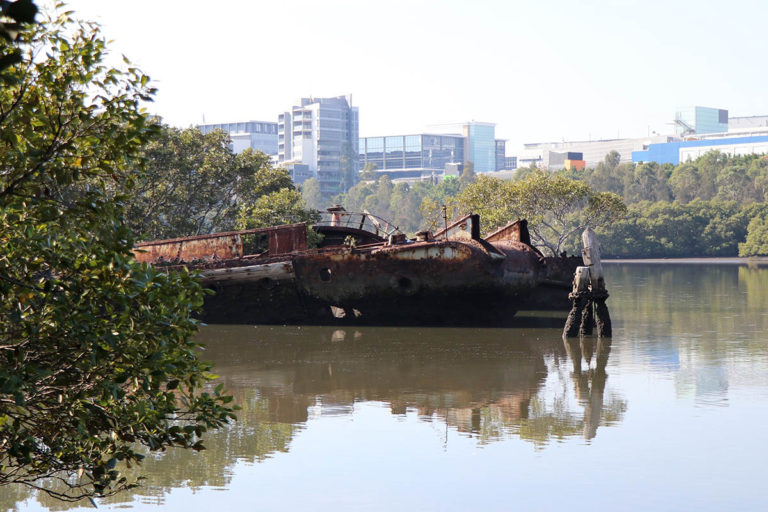
Originally name SS Corrimal, the ship was commissioned by the Commonwealth Government for the transportation of supplies to American troops stationed in the pacific regions during WWII. In 1951 it was sold and renamed SS Ayrfield, and used as a collier between Newcastle and Sydney until 1972.
Sydney Olympic Park NSW 2127
Stevenson’s Creek, Baulkham Hills
This scenic walk includes steep sections and creek crossings on stepping stones along rough bush tracks. It takes 2 hours and is suitable for moderate walkers.
Strathfield Council
One of Sydney’s best cycle and walking tracks runs through the Strathfield Council area. The Bay to Bay Shared Pathway is a 23 kilometre track running from Settlers Park in Ryde to Botany Bay, and much of the track runs aside the historic Cooks River.
Strathfield Council
Strathfield Council's bushcare program assists in the conservation and enhancement of natural areas. Bushcare volunteers meet once a month to carry out bush regeneration and weed management in areas that provide important habitat for species such as the endangered Green and Golden Bell Frog.
Strathfield Council
The Strathfield Local Government Area offers several walks, including the popular Bay to Bay Shared Pathway.
Strathfield Park
This large, popular park features grass and synthetic playing fields, basketball, netball and volleyball courts, two children’s playgrounds, barbecue and picnic facilities, public toilets, kiosk and a rotunda.
Chalmers Rd & Homebush Road, Strathfield NSW 2135
Strathfield Park
This large, popular park has two children’s playgrounds with a wide range of equipment for kids of all ages including a purpose-built bike track, stationary train, accessible swing, large climbing tower with tunnel slides, and flying foxes. There are also lots of shady areas, barbecue and picnic facilities, toilets and a kiosk.
Chalmers Rd & Homebush Road, Strathfield NSW 2135
Sydney Olympic Park Wharf
Facilities include wheelchair access, bike racks, Opal card top up or single trip ticket machine, covered gangway and pontoon, emergency help point, hearing loop, PA system for announcements and tactile surfaces.
Sydney Olympic Park NSW 2127
Sydney Rowing Club
Formed in 1870, Sydney Rowing Club is NSW's oldest rowing club. Located on Abbotsford Point with scenic views of the Parramatta River, the club offers rowing programs for people of all ages and abilities.
613 Great North Rd, Abbotsford NSW 2046
Taplin Park
Located next to Drummoyne Oval, this waterfront park includes picnic tables, a large covered playground, cricket nets and a boat ramp.
Cometrowe St, Drummoyne NSW 2047
Taplin Park
Located next to Drummoyne Oval, this covered playground has a timber climbing fort with slide, birds nest swing, and a rope climbing gym. There is also a large grass area and picnic tables.
Cometrowe St, Drummoyne NSW 2047
The Bay Run
One of the Inner West's most popular routes, the Bay Run follows the Parramatta River foreshore and travels through nine parks, covering Lilyfield, Drummoyne and Rodd Point. The loop is 7 km long and takes 1-2 hours at a moderate pace.
The Bay Run
One of the Inner West's most popular routes, the Bay Run follows the Parramatta River foreshore and travels through nine parks, covering Lilyfield, Drummoyne and Rodd Point. The loop is 7 km long and takes 20-30 mins to complete at a moderate pace.
The Dairy Cottage
One of Australia’s oldest colonial sites, the Dairy Cottage was constructed between 1796 and 1805 as a two-roomed cottage by ex-convict George Salter.
Parramatta NSW 2150
The Ponds Walk
The Ponds Walk is a 6.6 km track that follows Ponds/Subiaco Creek from Eric Mobbs Memorial Park in Carlingford to Jim Crowgey Reserve in Rydalmere.
Timbrell Park
This large park has an expansive grass area with multi-use playing fields, picnic and barbecue amenities, and covered playground.
Henley Marine Dr, Five Dock NSW 2046
Timbrell Park
This large park has an expansive grass area with multi-use playing fields, picnic and barbecue amenities, and covered playground.
Henley Marine Dr, Five Dock NSW 2046
Twin Gums Reserve
This local park has a walking path beside the creek, small wooded area and a playground.
Vardys Road, Lalor Park 2147
Twin Gums Reserve

This local playground has a colourful, climbing play gym, swings, small grass area and seating.
Norcott Rd, Lalor Park NSW 2147
UTS Haberfield Club
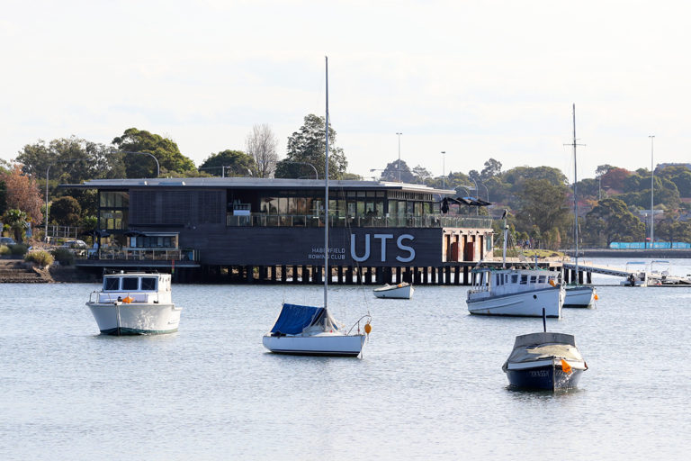
Owned and operated by the University of Technology, the club was fully renovated in 2013. The venue offers uninterrupted water views and is a great location to enjoy the beauty of the Parramatta River.
Dobroyd Parade, Haberfield NSW 2045
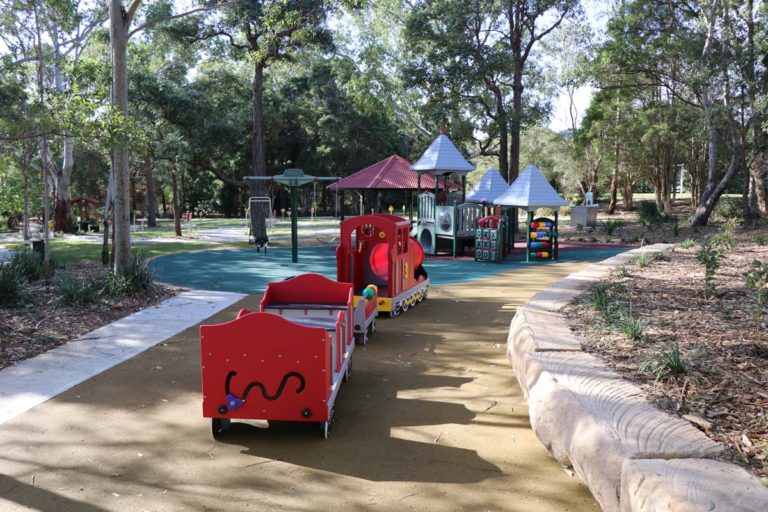
Village Green Playground – Bicentennial Park
Located in the 40-hectare Bicentennial Park, this large, partially shaded playground features a wide range of equipment to suit every age group, including a sand pit, swings, and large rope climbing tower.
Australia Ave, Sydney Olympic Park NSW 2127
Wangal Park
Covering over four hectares, this new parkland features wetland ponds with boardwalks, a shared path with exercise equipment, skatepark, half basketball court, large playground with a flying fox, and undercover picnic and barbecue amenities.
Royce Ave, Croydon NSW 2132
Wangal Park
Located on the Mortlake peninsula, this scenic reserve has spectacular water and district views. There are barbecues, picnic tables and toilets available, and ample tree shade for a relaxing picnic or day out.
38A Hilly St, Mortlake NSW 2137
Wangal Park
Located in a stunning parkland setting, this large covered playground has timber swings, climbing frames, activity panels and a flying fox. There are also wetland ponds with boardwalks, a shared path with exercise equipment, skatepark, half basketball court, picnic and barbecue facilities.
Royce Ave, Croydon NSW 2132
Waterfall Walk
Located between four significant Darug tribal areas, this walk follows Hunts Creek passing by the scenic Balaka Falls. The distance is 3.4 km and duration is 1 hr 57 mins return.
Webbs Avenue Playing Fields
This park includes several playing fields, fenced off-leash dog area, and public toilets.
Webbs Ave, Auburn NSW 2144
Weil Park
This park includes playing fields, covered playground, picnic tables and toilets.
Woolwich Rd, Woolwich NSW 2110
Weil Park
This playground has a climbing play gym, including slide and swings, shade structure and chipbark surface. There are also picnic tables and toilets.
Woolwich Rd, Woolwich NSW 2110
Wentworth Common
This extensive adventure playground includes a pirate-inspired crows nest with a mast and slide, spider's web climbing net, swings, flying fox, huge sandpit and stone animal sculptures. There are also plenty of places to explore on bike or by foot, such as the spiral Bay Marker lookout.
Marjorie Jackson Pkwy, Sydney Olympic Park NSW 2127
Wentworth Common
This park has something for everyone, including the Bay Marker lookout, adventure playground with flying fox, shared cycling and walking pathway, barbecue and picnic facilities.
Marjorie Jackson Pkwy, Sydney Olympic Park NSW 2127
Werrell Reserve
Overlooking the Parramatta River and a short walk to Abbotsord Rivercat wharf, this playground has a slide and see-saw. There are also barbecue and toilet facilities.
Teviott Ave, Abbotsford NSW 2046
Werrell Reserve
Located at the end of Great North Road in Abbotsford, Werrell Reserve includes play equipment, barbecue and toilet facilities, and is a short walk to the Rivercat wharf. There is ample shade cover and scenic views of the Parramatta River, making it a great place for a relaxing picnic.
Teviott Ave, Abbotsford NSW 2046
William Lawson Wetland
This picturesque parkland features a large, constructed wetland area, lots of ducks and other birdlife, walking paths and plenty of tree shade to find the perfect spot for a relaxing picnic.
54 Lancelot St, Blacktown NSW 2148
Wilson Park
Located on the Parramatta River, this popular park has several playing fields, barbecue facilities, playground, public toilets and car park.
Newington Rd, Silverwater NSW 2128
Woolwich Boat Ramp
There is a pontoon on the ramp, multiple parking spaces and grass area for picnics.
Margaret St, Woolwich